Garrett Fisher

Email subscription form header
Subscribe
Your email address:*
Please wait...
Please enter all required fields Click to hide
Correct invalid entries Click to hide
Powered by FeedBlitz
  • Writings
  • Documentary & Interview
  • Press
  • Economics
  • Maps
  • Flying Videos
  • TEDx Talk: Forget Economics
  • About Me

Powered by Genesis

Archives for September 2016

Flight: Spain: Cadí-Moixeró National Park, Pedraforca

September 25, 2016 by Garrett

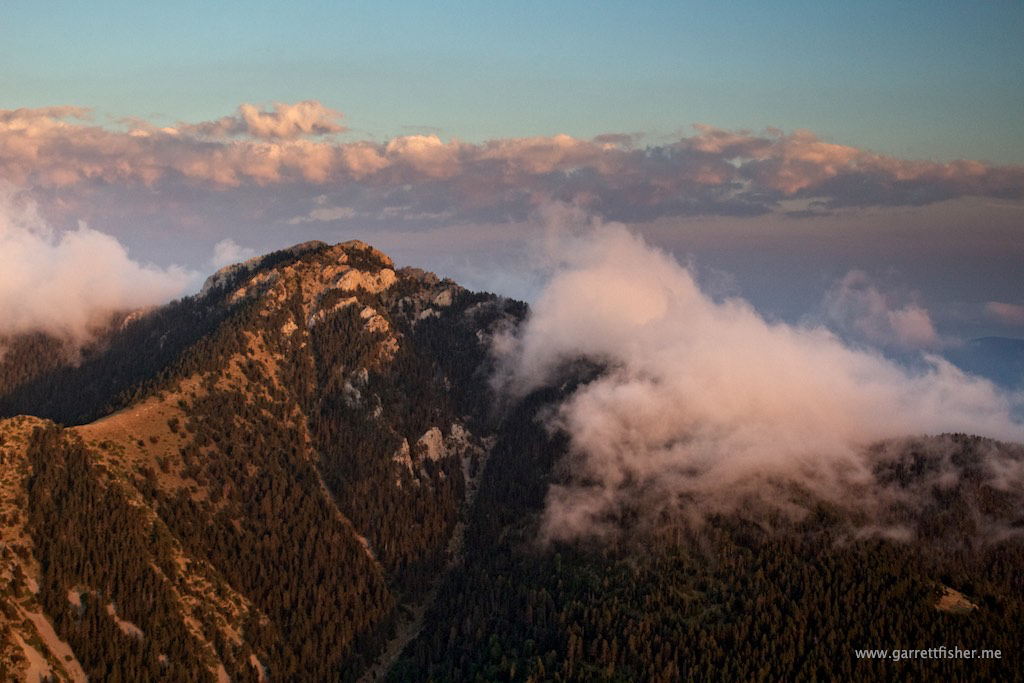
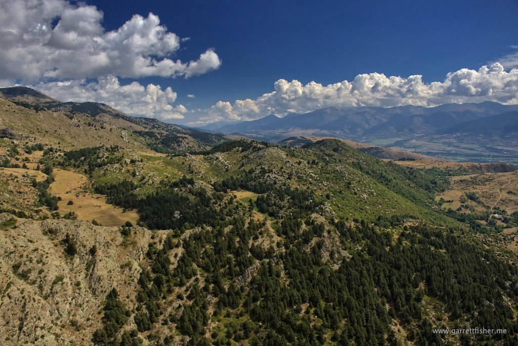
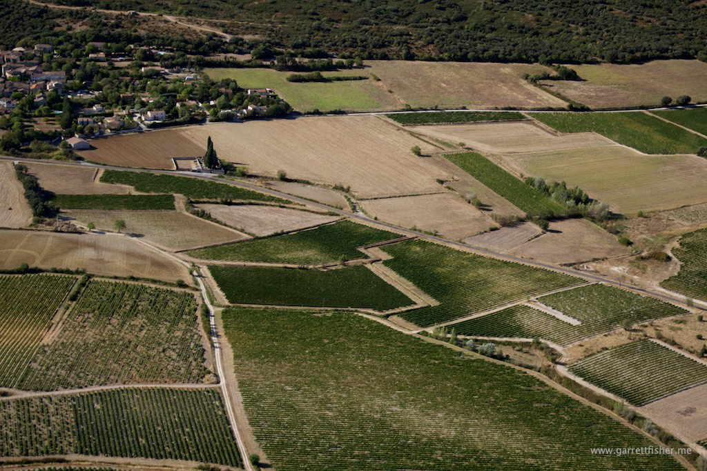
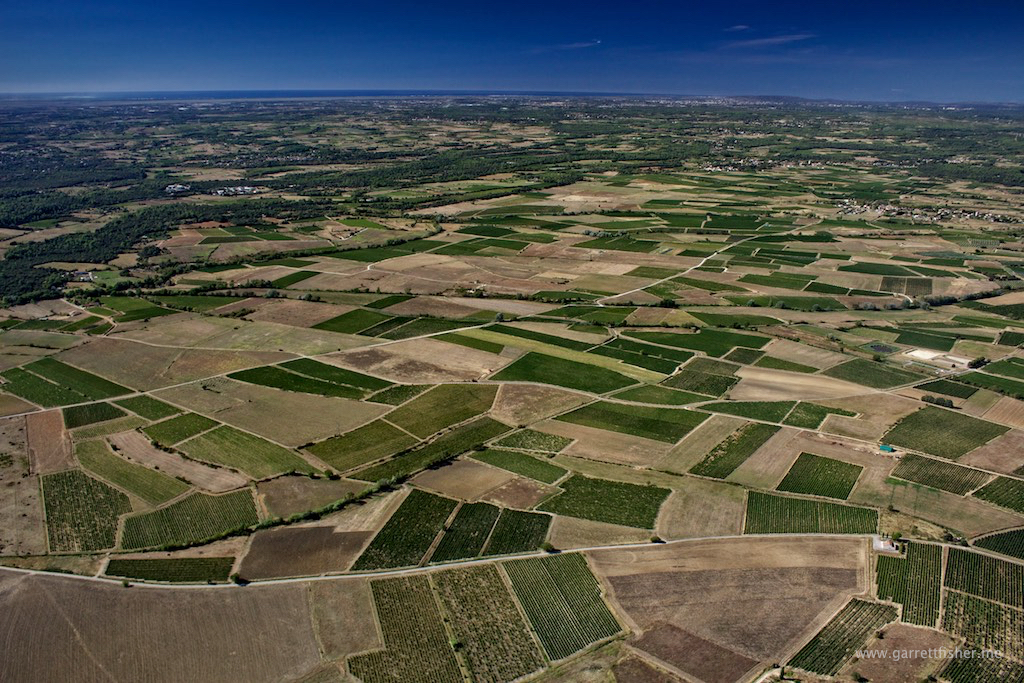
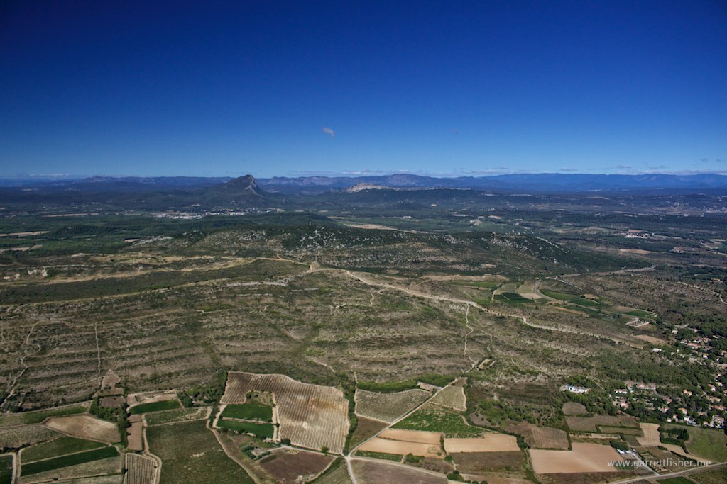
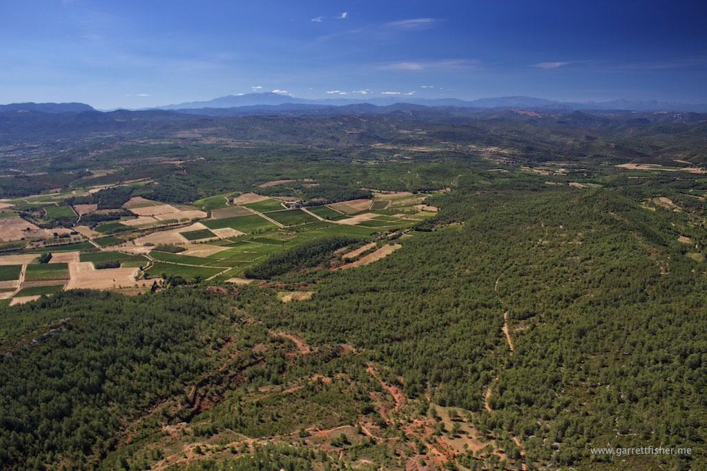
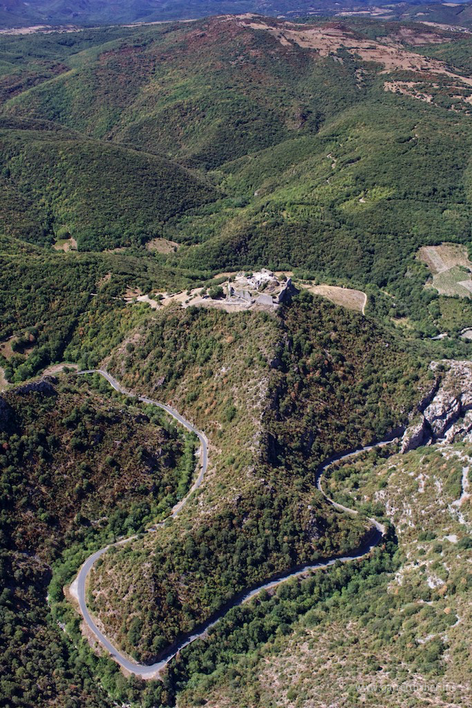
Just over the hill behind the house, there is a national park called Cadí-Moixeró. In essence, it is an aggressive ridgeline that looks like the Salt River Range of Wyoming, at least from below. I figured it was worth a shot to check it out.

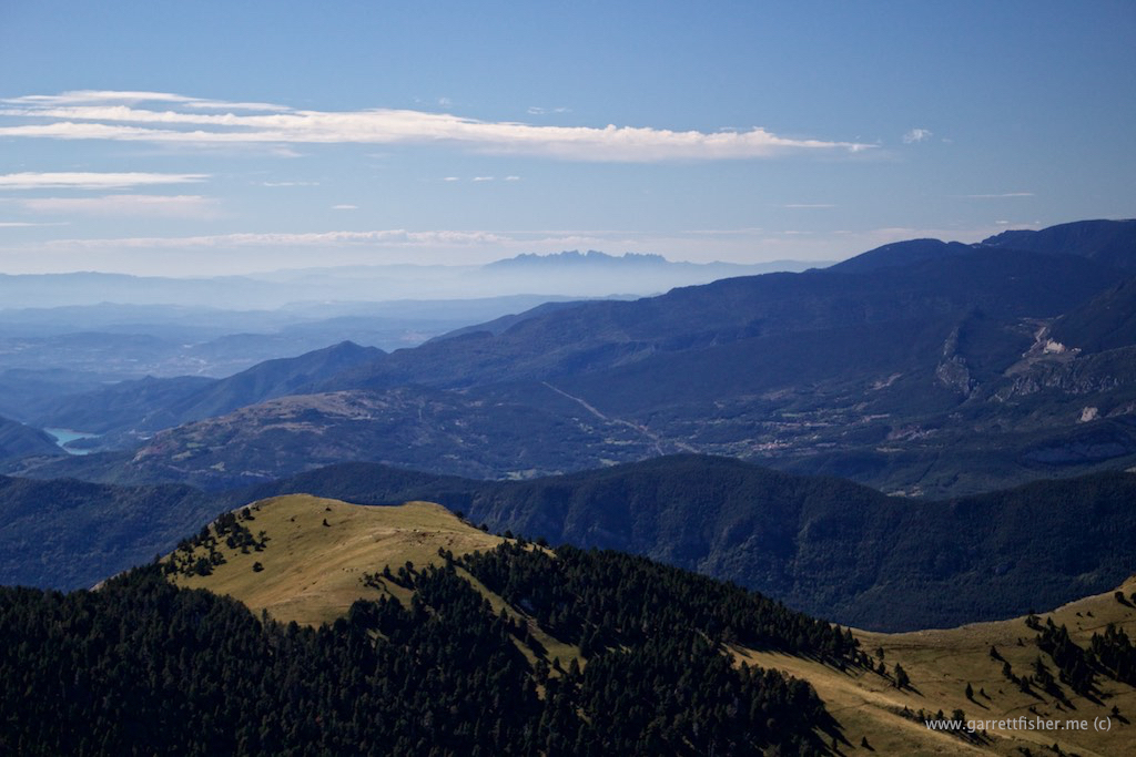
As I climbed the ridge over the house (the same one featured in my last sunset post), I laid eyes on Montserrat on the horizon for the first time. Montserrat is this incredible pile of rock most of the way to Barcelona. I saw it for the first time on a boiling hot and hazy July summer day as I was driving from Barcelona airport to the house to preview this whole shindig. Despite the visual discontent and my attendant shock at the prospect of moving from one foreign country to another, I made a mental note: I need to see this bad boy from the Cub. Well, here it is, at a distance. Stay tuned, I’ll get up close and personal one of these days.

Montserrat: Center horizon
img_1687-15-of-441

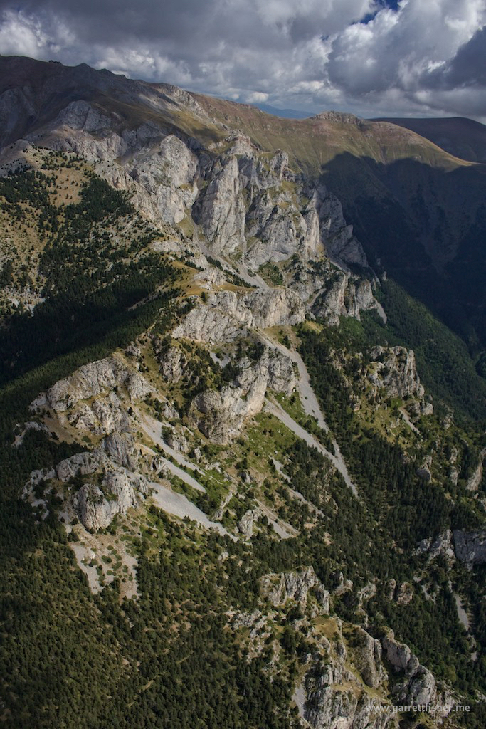
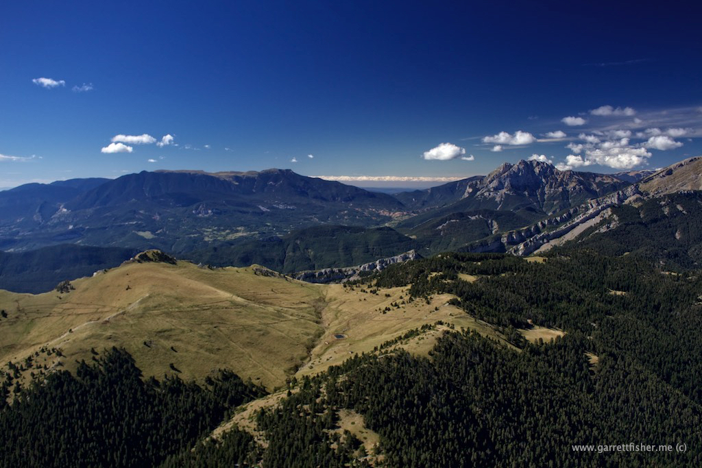
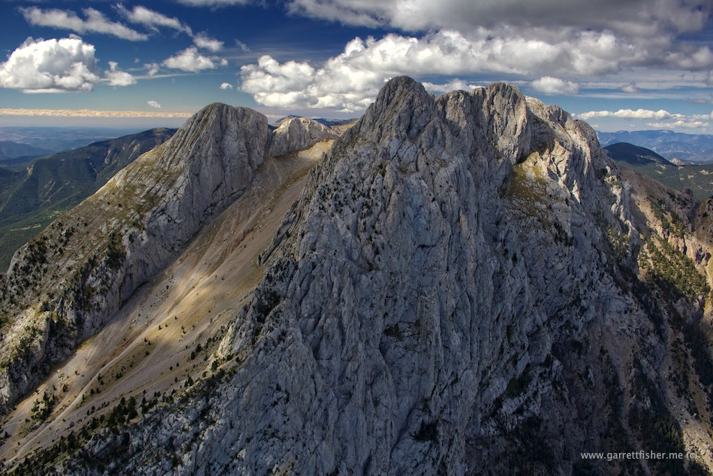
Then I saw something a bit closer. I have now been told it is called Pedraforca. It, too, is a giant pile of rock, though where Montserrat is wide and menacing, this animal is tall and menacing. You’ll see in the photos.

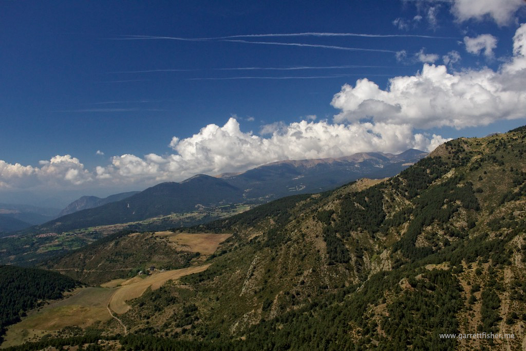
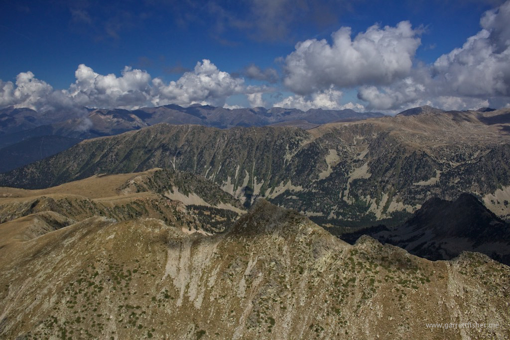
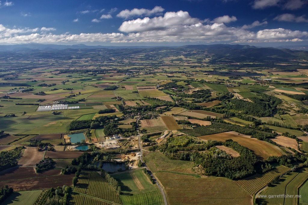
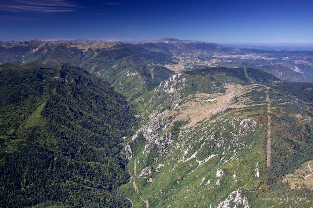
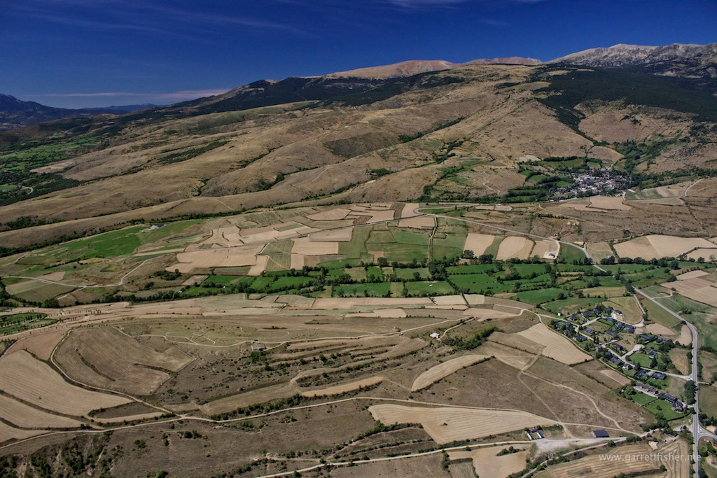
I proceeded down the Cadí-Moixeró ridge, around the other side of it, circled around Pedraforca, over La Massena and La Molina (this winter’s skiing playground) and descended down into La Cerdanya. The amazing thing about the whole flight is how close everything is, and how little I knew of what is hiding on the other side of the mountain.

Pedraforca to the right. I discovered that this exists when I climbed over the ridge below.
img_1691-19-of-441

Cadí-Moixeró
img_1757-85-of-441

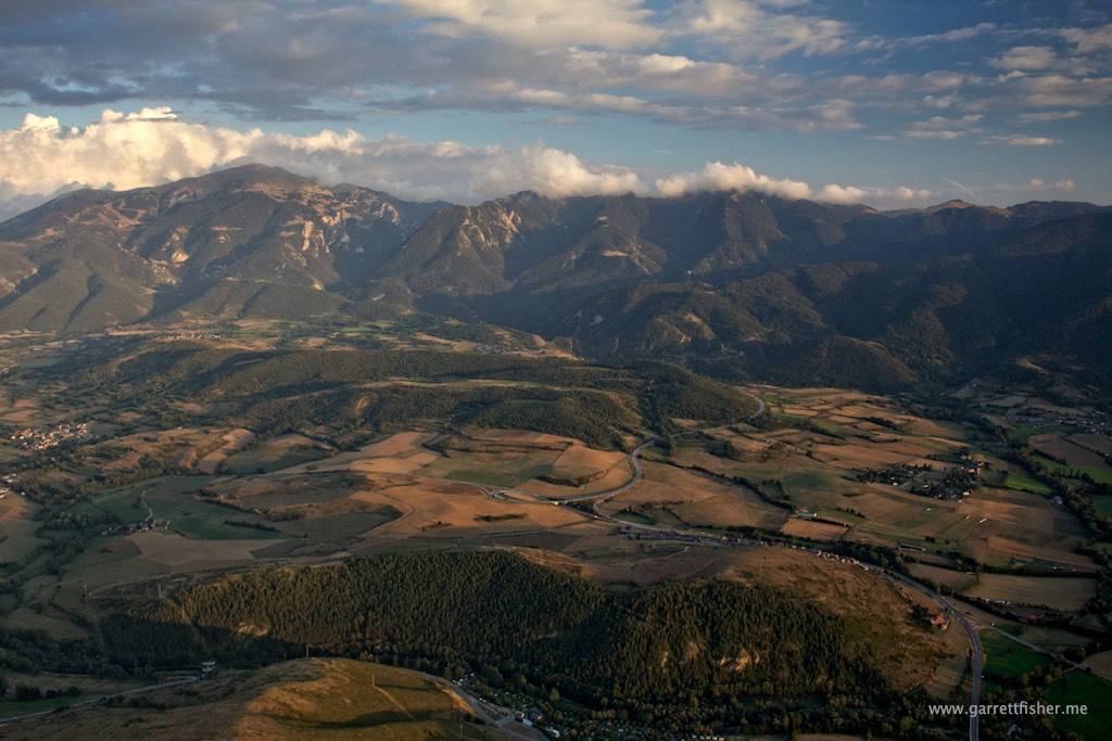
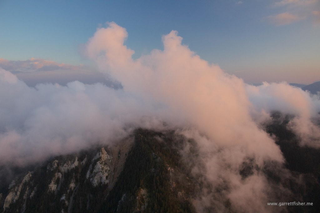
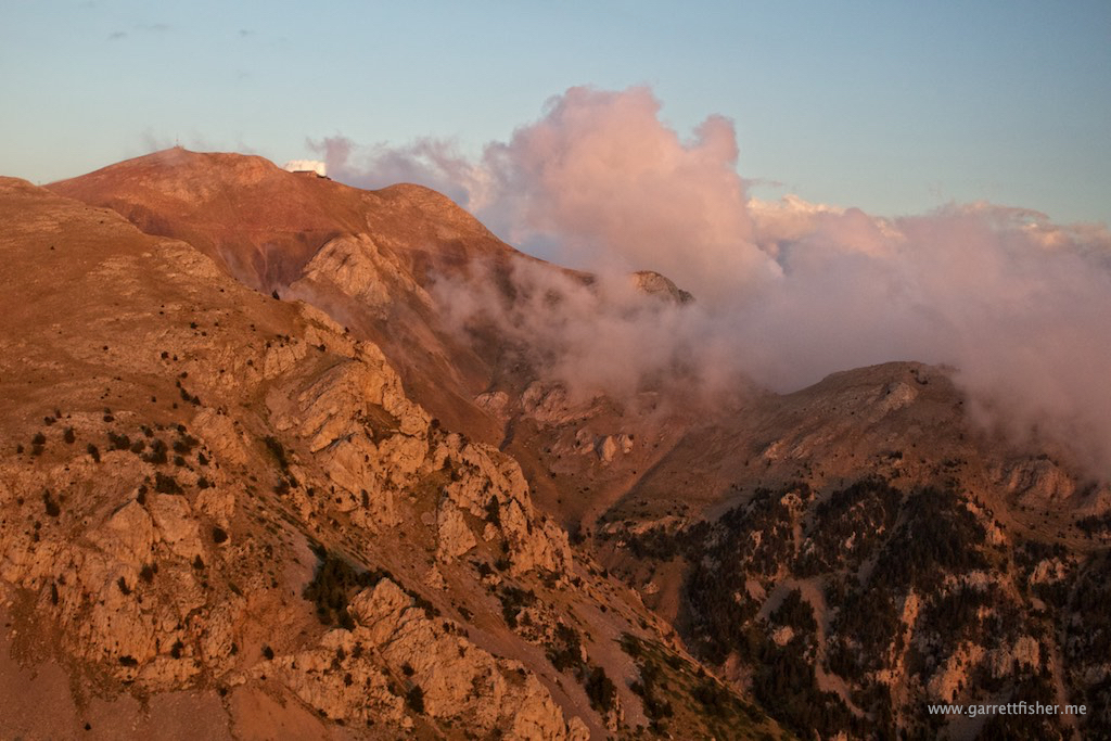
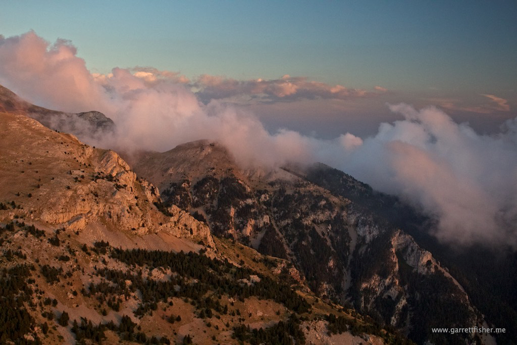
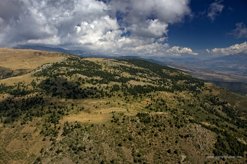
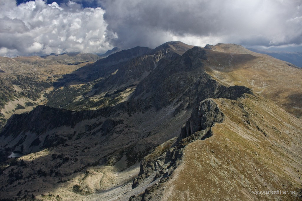
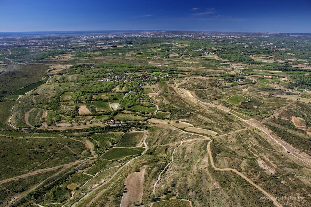
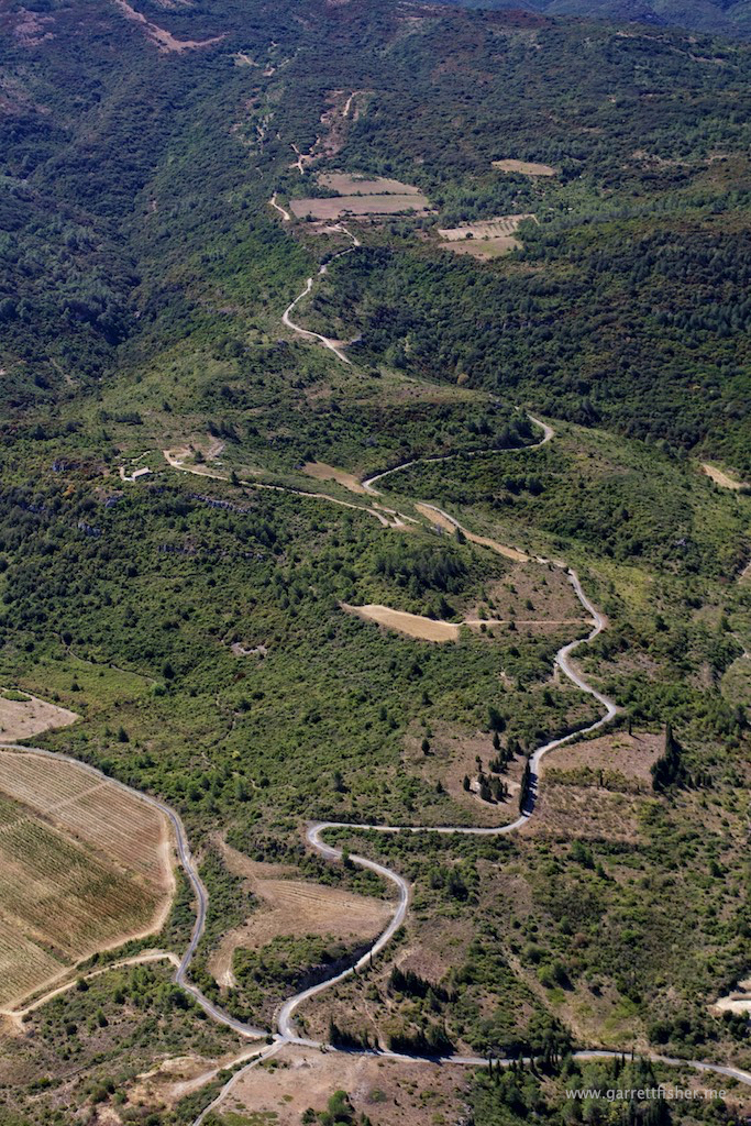
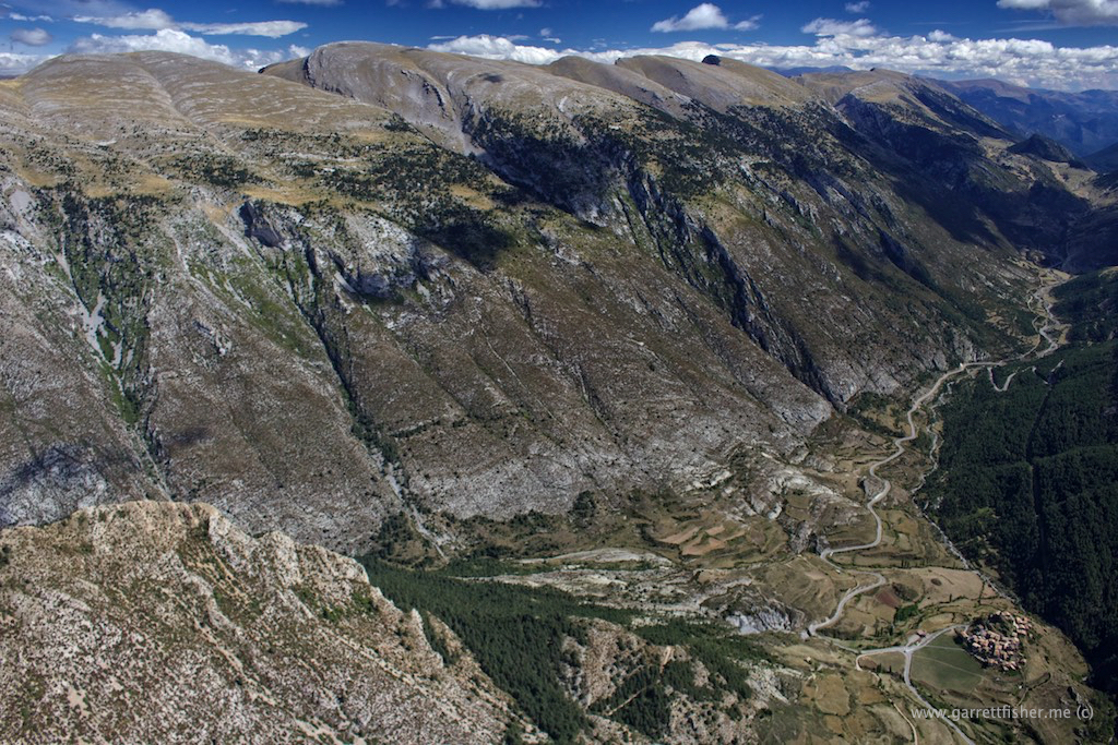
Cadí-Moixeró, other side. I’ll need to take that road down there sometime and check out what it looks like.
img_1830-158-of-441

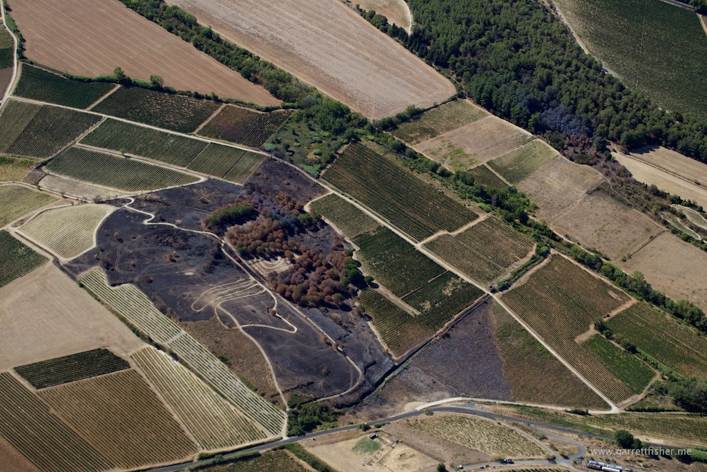
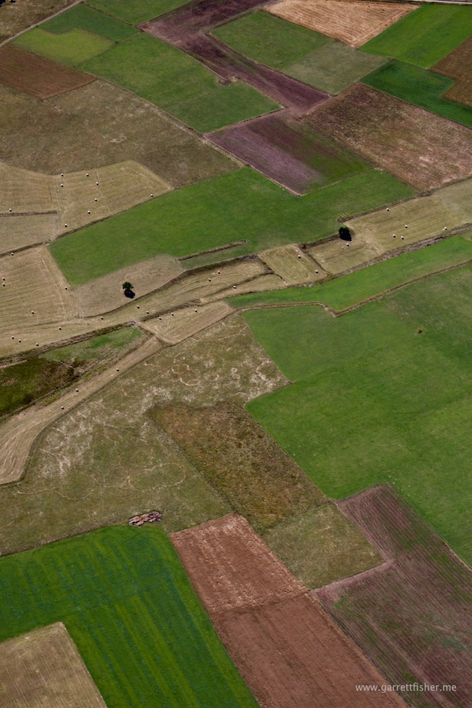
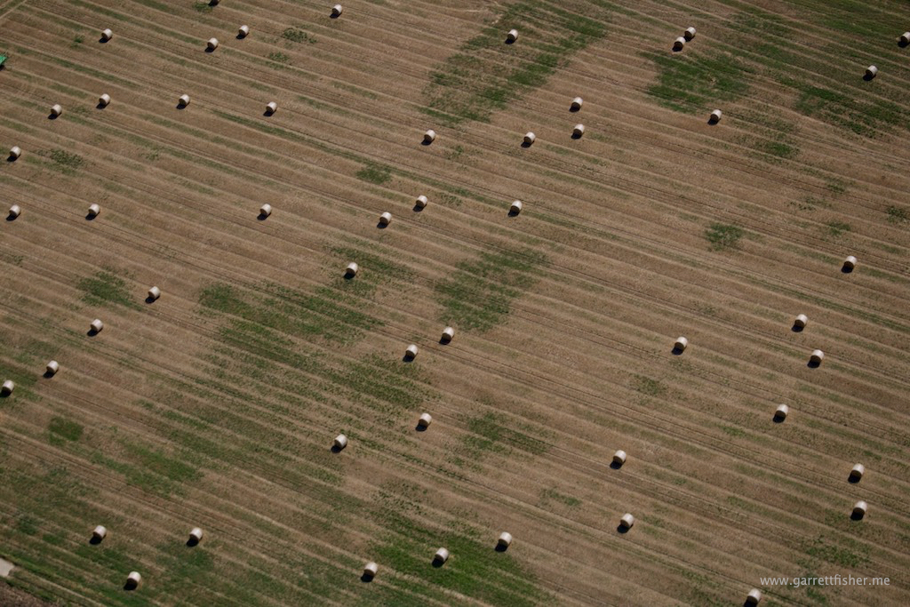
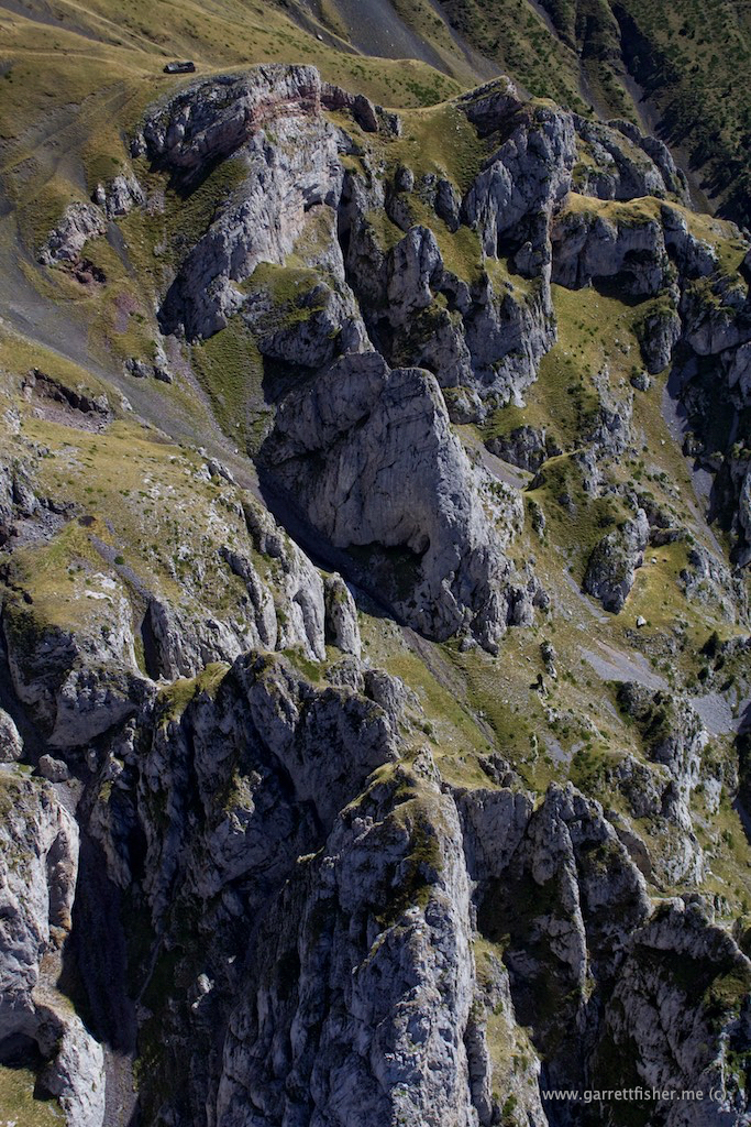
Note how the hay bales are arranged in the upper right quadrant.
img_1854-182-of-441

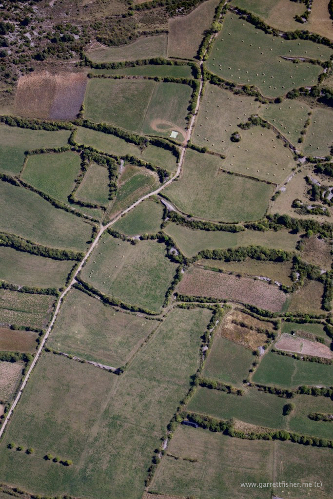
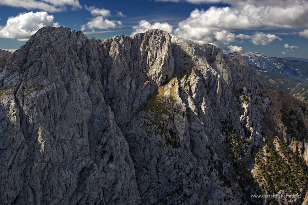
Those hay bales were at the base of this monster. Pedraforca!
img_1874-202-of-441

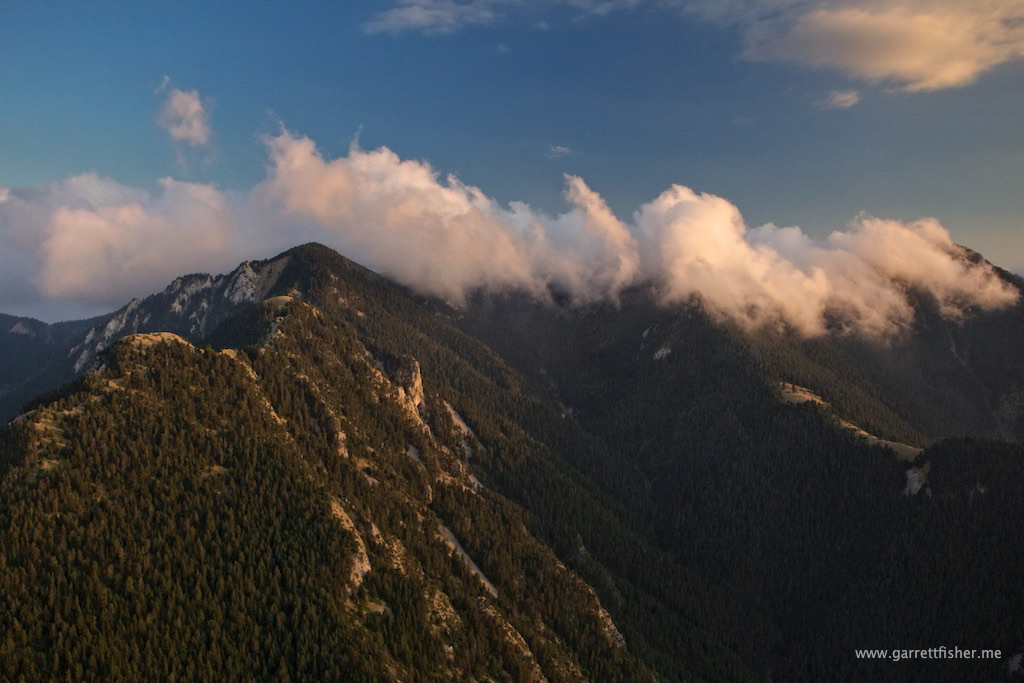
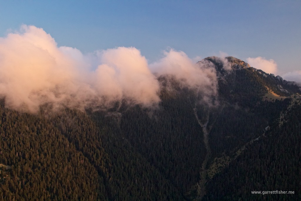
Other side of Pedraforca.
img_1901-229-of-441 img_1914-242-of-441

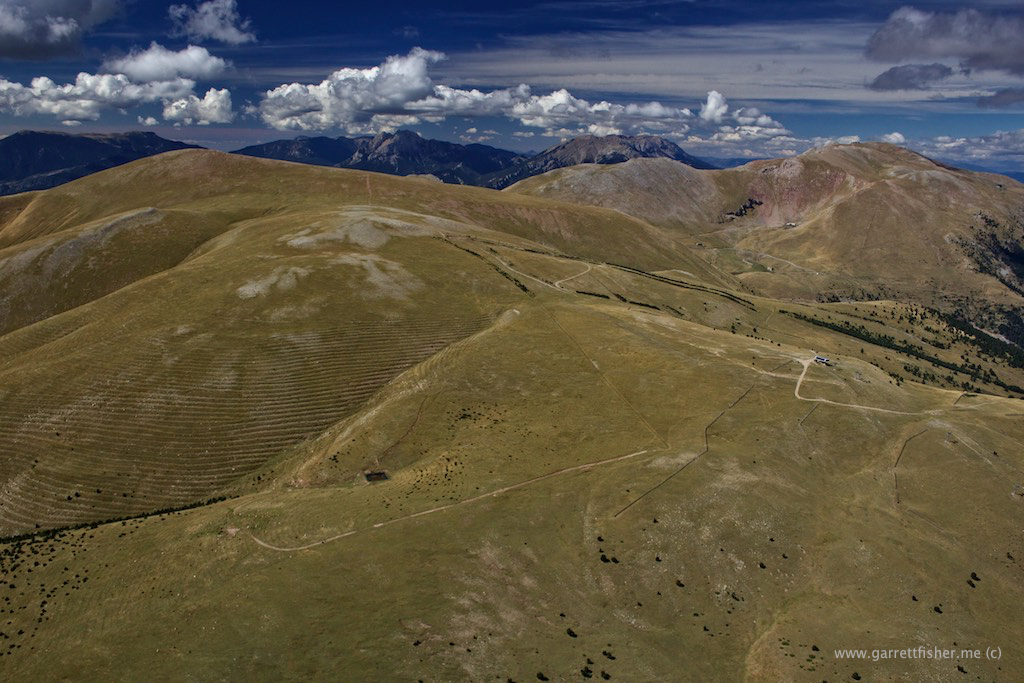
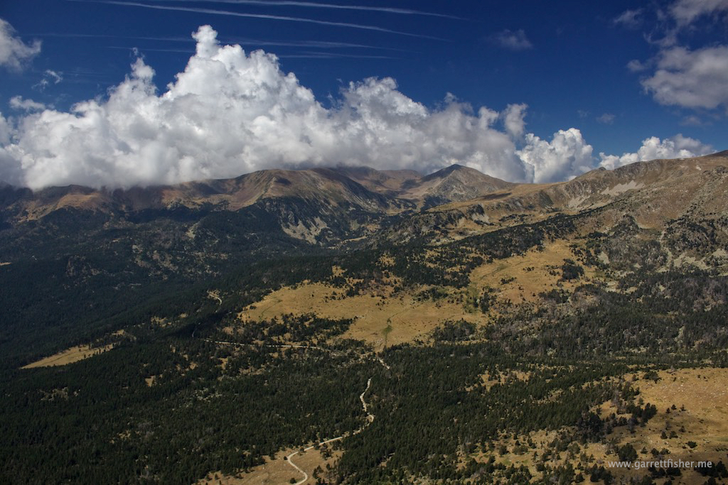
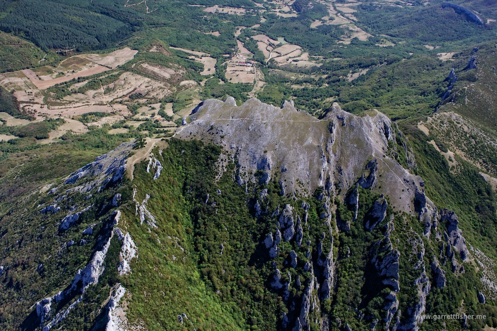
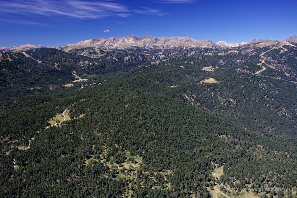
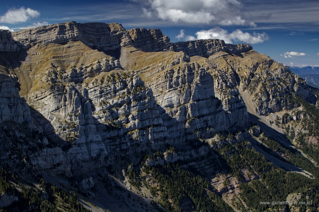
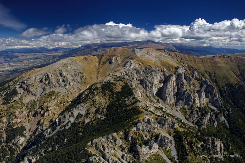
Cadí-Moixeró again. Note the similarities to the US West. Peak elevation is about 8,400′, showing the Pyrenees timberline of 7,500′ quite nicely.
img_1960-288-of-441

La Massena, west side.
img_2019-347-of-441 img_2037-365-of-441

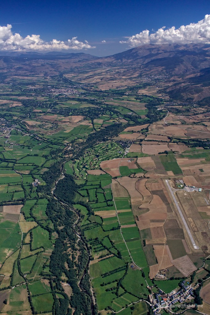
La Molina, looking west. Note the terrace on the center left. That inspired the purchase of a better lens so I can zoom more. Unacceptable that I couldn’t create an image consisting of nothing but those terraces!
img_2083-411-of-441


Filed Under: Uncategorized

Flight: Spain: Puigmal Range at Sunset

September 21, 2016 by Garrett

One of the advantages of being near the airport is the ability to run over and chase weather, color, texture, and lighting. Forget big ticket things, sometimes it’s the small stuff that’s cool.

I decided to fly up to the ridge about 7,500 feet above sea level, 4000 feet above the runway, which is behind the house, and had a cap cloud hanging out over it. Winds from Barcelona were blowing up to the ridge, cresting, forming clouds, and blowing down, with the clouds dissipating right over the ridge. I can’t say that I have ever been able to photograph something precisely like this from the air, and it was a classically pleasant sunset excursion.

La Massena to the left, little cap cloud in the center. We live on the center left edge of the image.
img_1548-56-of-180

This cloud is in constant motion, coming up from the other side, descending on this side.
img_1565-73-of-180

Note the avalanche path in the right third of the image.
img_1572-80-of-180 img_1575-83-of-180 img_1606-114-of-180

La Massena with sunset light.
img_1637-145-of-180 img_1641-149-of-180

Note the cap cloud on the other mountain range on the horizon. Barcelona is about 75 miles in this direction, obscured by Mediterranean moisture and Saharan dust haze. 
img_1664-172-of-180

Filed Under: Uncategorized

Flight: Spain, France, Andorra: La Cerdanya

September 18, 2016 by Garrett

For those into hardcore cartography, I have updated the Europe map on the front page with push pins for the flight down from Germany.

It only took a few days to want to get back in the air. That, and I had to hop over the border to Andorra, nudging a little into France as well, completing my first flight in three countries in one day, without having to refuel. So far, in the Cub: 25 US states, 6 countries, 2 continents. We’ll see about pushing that number up, though it will take a bit as Italy and Portugal are the nearest unvisited countries. Well, wait a minute, there is the micro-nation of Monaco.

It is nice to be back in the saddle with mountain flying. The airfield is at 3,609’ MSL, with mountains on the south side up to about 8,500’ and 9,500’ on the north side of the valley. The pass climbs to 5,500’ on the east side of La Cerdanya, and drops to about 2,500’ on the western drainage area, eventually winding down to the Mediterranean.

While not as high as Wyoming or Colorado, the timberline here is 7,500’ instead of 10,500’ in Wyoming, and 11,500’ in Colorado, so the rocky prominences appear just the same.

This time of year, grasses are brown due to summer heat. The mountains on all sides get quite a bit of snow, so things should get very pretty rather soon.

Trying to catch some lift, France.
img_1149-26-of-270

Trying back in Spain instead.
img_1170-47-of-270

Getting there….
img_1183-60-of-270

Approaching Andorra, lift seems to be working.
img_1199-76-of-270

Reminding me a bit of the US West!
img_1203-80-of-270

Sovereign micro-nation of Andorra!
img_1249-126-of-270

Andorra to the left, Spain to the right, elevation 9000 feet or so.
img_1261-138-of-270

La Cerdanya, with new home airport below. France is the top third of the image.
img_1328-205-of-270

Ridgeline behind the house, 7,800 feet or so, Spain.
img_1339-216-of-270

Filed Under: Uncategorized

Flight: France, Spain: Day 2 of 2: Flight to Spain

September 15, 2016 by Garrett

I neglected to mention in my prior post that I only got a radio for this airplane in June of 2015. Prior to that, my only radio activity was a little bit of private certificate training in the 90s, an occasional aircraft rental, and some commercial certificate training a few years ago. Since acquiring the radio, I made roughly 10 landings at a control tower and two contacts with flight service in the USA in the span of a few hundred hours of flying. Everything else was uncontrolled airports, wide open spaces, or, prior to the radio, crossing the USA multiple times without a radio at all. This French business was very close to being on an instrument flight plan, except without the added benefit of having radar services handed seamlessly from one frequency to another. Then there was the matter of French accents….yikes.

My standard modus operandi is to avoid controlled airspace. I don’t want to have to ask for clearance; I’d rather fly like a path that looks like I am drunk, weaving in and out of free airspace to go where I want. The problem was, I was now committed to heading into the South of France, and I’d have to get permission. On top of it, half of the little uncontrolled airports were restricted use, forty percent required a French fuel card that I didn’t have or 3 days notice to pay cash (that I didn’t do, refer to prior flight “plans” going to pot), and the remaining ten percent were viable. With miserable weather still over the Massif Central, 10 percent airport availability, and silly control zones, I plotted a course for clearance through only two restricted areas. Things should work out good.

That was until I got to the airport. The forecast called for La Mistral from hell out of the north, but only in the afternoon. By 10AM, it was blowing at 26 knots, so much so that it lifted the airplane onto one wheel for a moment while I was pushing over to fuel. Not good. With a lack of tie downs, I just needed get out while I could still taxi perpendicular to the wind. It called to mind advice from my German friend, whom I shall call “George W,” the nickname provided by his son, who told me about La Mistral months ago. “It is so strong, you do not overcome it!” (barked with sufficient German rage). Some of his other advice turned out to be a bit on the dramatic side, so I tossed this bit of wisdom into the gutter. It turns out, it was one of the things he was very correct about.

I took off midfield to avoid having to taxi with a 26kt wind from behind, and cleared pattern altitude by the end of the runway. Turning south, I was doing 110 knots ground speed, a tailwind of 35 knots, on an otherwise sunny and pretty French morning. Within 15 minutes, things went to pot when I called Marseille Information.

“Restricted area active.”
“Active. So I can’t fly through it?”
“Non.”
“Can I get cleared?”
“Non. Contact Orange Approach for further instructions, good day.”

Now, instead of heading southwest where I hoped winds wouldn’t be so crazy, it was straight south, to within 20 miles of the Mediterranean. Even worse, Orange Approach requested descent to 1700’ above sea level, meaning that I was flying through rotors generated over little hills. Literally, there were small dust storms, raging wind, turbulence, and rotors, as I was trying to maintain ATC assigned altitude. I almost had to advise that I could not comply with altitude assignment, then an updraft brought me up to 1700’ and beyond, having then to pull power and nose forward, remembering my commercial instructor’s words: “positive control of the airplane. In other words, do what it takes to comply with ATC.”

Orange Approach was very confused that I was heading along the western transition yet not heading southeast toward the hellishly complicated scenic tour of the Cote d’Azur; rather, I was heading southwest. Eventually, I was freed from the shackles of ATC, liberated to fly through turbulence under my own wishes.

Eventually, it became time to get cleared through another restricted area. Contacting Montpellier Information, I was told that the zone was active, and climbing to 3000 feet was recommended, which I did. Thankfully, I was able to avoid the inaneness of turbulence. Sometimes I forget that higher altitude is available, as I grow very accustomed to staying around 1,000’ AGL.

While flying through this section, I was able to witness sand blowing along the beach in Montpellier, from a distance, and blowing clear out to the Mediterranean, staying airborne for about two miles over the water. The wind was so unreal, it reminded me of flying in the western prairie of the USA, and also the area of Montana where the winds funnel off of the Absaroka Range into the wide-open prairie. Both are places where I have had to land on airport lawns or sagebrush fields, as winds changed rapidly and were in excess of 30 knots, rendering crosswind landings impossible. I was beginning to wonder if my plan of getting away from La Mistral on one tank of fuel was doable.

For that matter, should I even be in the air in this crap? Sure, it’s sunny, though what if there is engine trouble? Looking at the abundance of fields available in the south of France, I realized that an emergency landing would be like a helicopter. With 40 knot winds and a 23mph stall speed with vortex generators, I could descend like an elevator into a very tight spot. Maybe this isn’t so silly!

Montpellier Information transitioned to Montpellier Approach to clear some control zones due to altitude. I took the chance to get an observation on winds at my intended destination: Lezignan, France: 28 knots. That would explain the windmills swirling at a fury. Perpignan was no better, and I would come up short trying to clear the Pyrenees on this tank. Fiddlesticks! Checking my notes, the 28 knot “breeze” was within 20 degrees of runway heading, so touchdown would be fine, especially on an angle over the asphalt. The only problem was a 45-knot approach speed, the world’s longest long final.

Perpendicular taxing required full right rudder to go straight. Thankfully, winds were level, as opposed to turbulent, so they did not want to come under the wing and cause any trouble. After fueling, I was informed that this wind is La Tramontane, different from La Mistral, and it blows quite a bit from the west/northwest, instead of north/northeast like its sister over in the Rhone valley. This wind funnels between the Pyrenees and the Massif Central. While named differently, the theory is the same. There is a French saying “C’est le pays du vent,” (“It is the land of wind”) which I seem to have learned in a rather immersive way.

I was unsure about taxing perpendicular again, and I asked if I could take off from the fuel ramp. The controller (fees are paid in the tower) had a sort of…unsure…look on his face, so I asked “Can you literally just look the other way while I do it?” That elicited a laugh, and then he offered to come out of the tower and hold the wing so I could taxi into position, which I accepted, remembering my late first instructor’s wisdom: “If you ever land in such wind that you can’t taxi perpendicular to it, call Unicom and ask for someone to hold the wing for you while taxiing.”

Climbing the eastern side of the Pyrenees was interesting, requiring detective work to manage restrictive French airspace coupled with winds blowing in directions parallel to terrain, as opposed to perpendicular. With perpendicular wind, I can soar like a glider. With parallel, I get knocked around and can only seem to find downdrafts, which is what happened here. I am quite thankful I didn’t try making it all the way to Spain on one tank, as that would have ended poorly.

Finally reaching shy of 7,000 feet, I approached La Cerdanya (La Cerdagne on the French side) from a valley spur that I had not yet driven. What I found reminded me of Colorado: thick stands of pine, a solid timberline, and mountains that looked a lot like the Rockies. There was even a pass 30 minutes from the house in France that was a pine-covered plateau, a place to snow shoe and cross country ski. Home, what a wonderful feeling, not just the sense of a place to call home, but also to find one that, on a deep level, connects to what I like.

As I crossed the Spanish border, I aimed for a downwind leg entry to my new home airport, noticing how utterly beautiful this place is from the air. The air quality was immensely clear and the countryside a work of art. That was spiritually mesmerizing, until I rammed into heavy turbulence and rotors at pattern altitude, getting the snot beat out of me as I was about to turn base. I opted to extend until the guerre de l’aire was won, turning base in more manageable air. It was all very puzzling as the windsock was not indicating much.

After landing, I asked a local why I got knocked around, given that I had previously asked what to expect and was told that the place doesn’t have any negative effects of mountains on wind (seriously? I actually believed that? How many mountain places have I been based at to know better?). “Oh, normally its good. Well, except, on north wind days like today. Its great for gliding, you just don’t want to be doing powered flight on a day like today.” [Eye roll] The real estate agent also told us it’s not a windy place at the house, and it blows like a hurricane down from the Puigmal Range most afternoons. I was told by someone else that the “national sport of Spain is lying and corruption.” I suppose I would have rather found that out on the ground and not in the air.

While it appears pleasant, the wind is blowing with a fury.
img_0662-662-of-1112

Enigmatic French tree and orchard patterns.
img_0673-673-of-1112

Le Rhone – the surface is a sign the wind is blowing like crazy.
img_0680-680-of-1112

Convergence of Le Rhone, south of Montelimar.
img_0688-688-of-1112

Somewhere NW of Avignon
img_0701-701-of-1112 img_0716-716-of-1112 img_0728-728-of-1112

Vineyards, NW of Nimes, Mediterranean on the horizon.
img_0750-750-of-1112

Looking back toward the Massif Central
img_0779-779-of-1112

North of Montpellier
img_0790-790-of-1112

West of Montpellier, Mediterranean still on horizon
img_0810-810-of-1112

Vineyards, instead of farm fields.
img_0827-827-of-1112

Herault River
img_0846-846-of-1112

NE of Beziers, Pyrenees on right horizon, Mediterranean on left.
img_0876-876-of-1112

Between Narbonne and Beziers, strange massive crop circles.
img_0879-879-of-1112

“Only you can prevent vineyard fires!”
img_0884-884-of-1112

This is just plain bizarre. The French have ongoing national deficits and this is a priority? Then again, let’s not talk about American finances.
img_0886-886-of-1112

Languedoc region of France. These are all vineyards.
img_0901-901-of-1112

NW of Narbonne, entering La Tramontane wind, Pyrenees in the background. Home is in those mountains, though I need to land first with windmills spinning at obscene speeds.
img_0931-931-of-1112

Sneaking under restricted French airspace into the Pyrenees.
img_0954-954-of-1112 img_0958-958-of-1112

Château de Termes – This is what I love about flying in Europe. In the US, this whole area would be conservation land, lacking ruins from a giant castle built in an enigmatic location. The Europeans managed to preserve the rural and largely uninhabited character of many areas, while keeping interesting things like this stuffed in neat nooks and crannies.
img_0981-981-of-1112

This rock is not labeled on Google Maps. I am heading into the middle of the terrain on the horizon. I haven’t done mountain flying since last year!
img_1000-1000-of-1112

I would think this deserves a name, but apparently not.
img_1015-1015-of-1112 img_1032-1032-of-1112

Note the little village, just to the right of the center image. I intend to drive there by car to check this sneaky little place out.
img_1049-1049-of-1112

High altitude French Tetris.
img_1070-1070-of-1112

Looks like Colorado! French Pyrenees.
img_1091-1091-of-1112

Farm fields – La Cerdagne, France.
img_1100-1100-of-1112

Spain on the hill to the left, France to the right, Andorra over the horizon.
img_1105-1105-of-1112

Spain! Getting the crap beaten out of me downwind for 07. Why the heck did I believe someone when they said that ridge produces no adverse wind? Its a peak at 9,500 feet above sea level!
img_1111-1111-of-1112

Filed Under: Uncategorized

Flight: Germany, France: Day 1 of 2: Flight to Spain

September 13, 2016 by Garrett

You’re probably wondering why I would take a flight of such great length, at such great expense, and with such a high deal of aggravation. Well, it’s the flight to move the aircraft to Spain, as that will be our new home.

“Didn’t you just move to Germany?” Yes, we did last winter, and two factors conspired: the family that owned the house in Germany needed to move back in, thus we could not rent it any longer, and I reached my tolerance of German rules when it comes to aviation in mid-May. It was one of those quietly decisive and powerful moments, where I became aware of yet another senselessly silly and costly regulation from the Fatherland, so I decided to make the best of an unfortunate need to move so soon and find a place better suited for aviation.

I will be diving into greater depths behind the differences in aviation for each country and why another airport in Germany would only partially solve the problem in a post for AOPA. For now, understand that the Spanish are laid back, the place is beautiful, I speak Spanish, and its only €20 per month for unlimited landings at my new home field, instead of €7.98 each time!

The actual physical move was much more unpleasant than moving around the United States. I owned a pickup and a large trailer on the west side of the Atlantic, and I knew the exact cubic footage of everything we owned: 527. Now? I had to rent a van (and do so a month in advance, because nothing in Germany is last minute), and I had to get it right, even though there were many additions and subtractions to our possessions. We ended up leaving a set of dressers and playing the longest game of adult Tetris in my life.

Next up was the 14 hour drive through France, unload the next day, then drive it back to Germany. There are no one-way moving van rentals in Europe (kind of ironic, don’t you think?), so it was 12 and a half hours back to Germany. The next morning, the weather was just doable to fly the plane south, which was fantastic, as returning to Spain, only to return to Germany, only to return to Spain would have been stupid.

Much like my continental crossings in the United States, the weather turned out to be worse and incorrect, something I discovered in flight, and it made for loads of interesting fun.

The flight to the border of France in the Rhein valley worked out good (do I call it the Rhine, der Rhein, or le Rhin?). I had to scud run in Class G visibility due to some rain showers, with flight following in Germany and France, due to the border crossing. Eventually, the air cleared up west of Strasbourg, and I proceeded to my first stop under overcast skies and good visibility: Colmar, France.

The first thing that I noticed was that the tower controller allowed American-style point A to B movements. I was coming from the north, so straight in for runway 19 approved, no rigid goose-stepping in the pattern, flying arbitrarily and precisely over a circuitous path on a map. Fuel was uneventful and the French were quite helpful with my wandering confusion. The Germans had made clear that the French are nothing short of a pain in the ass, and I found that they were really nice and seemed to enjoy aviation, whereas Germany seems to as a nation be waiting for the slightest excuse to ground aircraft.

The weather to the south of Colmar was menacing, as depicted on radar: the remnants of a low pressure system slugging southeastward over the Jura Mountains that border Switzerland and France. I opted to head SW over the Parc Naturel Regional Ballons des Vosges, a mountain range exceeding 5,000 feet in elevation. For some reason, the clouds appeared clearer over the mountains versus trying to cross the Mediterranean-North Sea Continental Divide at a much lower elevation. Crossing over the ridge, it was so-so, therefore I opted to turn south, then southwest, and tried going back under the clouds. Nope, too low. Climb back up and head west, and the clouds were forming a bit of a wall over 10,000 feet in height, so I hopped on to Bale Information, requested flight following, and slalomed around clouds as I turned NW. Bale quickly handed my off to Luxeil Approach, who was extremely helpful, even calling a few small airports to get ceiling conditions on the ground. The entire time, I could see the ground and could turn around to land at a few ultralight fields if I had to.

It was a very interesting experience to not have radar in the cockpit, and to ultimately know little about where I was on the planet. Sure, I had GPS, so I wasn’t lost, it was just that it was the first day ever flying in France, and my weather fixation couldn’t be satisfied like it could in the US. I am the guy that reads 3 page forecast discussions to entertain myself, to know the 15 factors as to why it’s sunny today. In La France? Not happening. TAFs, METARs, radar, satellite, flight service, and using one’s brain. It was a sort of domain agnostic approach, turning the land I was flying over into a professorially generic patch of ground and reacting accordingly. I could presume little except that terrain rose to the left, that weather was moving right to left, and make decisions based on what I saw.

Heading northwest now to avoid weather, I descended around the clouds over an airport reporting 1200 foot ceilings, and then turned southwest noting declining ceilings to my left, and better to my right. The weather system had been coming in from my right, and I was really trying to turn south to my left. That meant that things ultimately were improving, just not where I was going. I was paralleling the border of flyable weather, roughly heading in the direction of where I needed to be, my original plan now completely mashed to bits. This is, of course, why I think the idea of flight plans is more stress than its worth, as reacting to dynamic changes in the air now runs afoul of a previously made plan. In my case, I only had filed a flight plan for border crossings, so that turned out ok.

I transitioned to VFR, terminating Luxeil’s radar service, flying at 800 feet above the ground, cruising along over French countryside. Eventually, the foothills of the Jura Mountains were showing up, as was a lower ceiling picture. I opted to land at Gray, France to see things through.

Two hours later, I tried again, and the route to the south was better. Gray had no fuel, so I landed 30 minutes south in Dole, France, at a towered field to fuel up. Yet again a Ryanair destination, I cringed at what the fees would be, and it turned out to be obscenely cheap compared to Germany: €11 landing fee and fuel that was 25% cheaper.

I considered spending the night, as the ceilings were just messy. I waited with two Luxembourg registered aircraft, pondering if they should file IFR or not, or if they could even make it back home to the Grand Duchy of Luxembourg. I was just concerned if I had 800 feet ceilings or not to the south, and I couldn’t get much in the way of reliable weather other than a few METARs to the south. Things were better over Lyon, and Valence looked like a good place to spend the night.

I finally decided to make a go of it, with the proviso that I could turn around and land if need be. Taking off, things were better than before, so I proceeded straight south, clearing the mucky weather and low ceilings about 40 miles away, settling into the Rhône Valley with the Pre-Alpes to the left, and the Massif Central to the right, both shrouded in low ceilings. I opted to clear the Lyon area, France’s 5th largest city, by skirting to the east of Saint Exupéry Airport. I recently learned about Monsieur Antoine de Saint-Exupéry, and I think the guy is someone to look up to. While flying for Aéropostale, he used to both read and write novels while flying, only to end up getting lost due to his focus on literature in the cockpit. Sadly, he expired due to a plane mishap off of Marseille. Perhaps that part shall be left out. Nonetheless, he is a national icon of France.

Passing over the ridge between Lyon and Grenoble Chambery Airport’s control zone, the wind began to pick up, and true to form, Le Mistral was blowing as I landed in Valence, France for the night, winds at 20 knots or so out of the north. I had to find some blocks and cut an extension cord I use for charging the airplane battery to tie the airplane down, as no one was on site, and there were no tie downs. Le Mistral is a famous wind of France, funneling like a venturi from the northern part of the country, down Le Rhône, and out to the Mediterranean Sea. In effect, the Pyrenees, Massif Central, and the Alps attempt to block the westerlies, and there are two low elevation outlets where the wind blows with an unholy fury. Tomorrow’s flight would prove that reality.

I finished the day eating some glorious French food at the hotel (when in Le Rhône, do as Les Rhônians – that is probably not a French word) and thought to myself that the flight of the day was the craziest I have ever done. It wasn’t so much being in a dangerous situation, it was the newness, ambition, workload, surprises, and amazing scenery that did it. Certainly, it didn’t come anywhere near other flights in length, and yet I wonder now whether it was this one or the next day’s that was the craziest.

Rhein Valley, Germany
img_5174-12-of-276

Crossing the Rhein
img_5183-21-of-276

German Agricultural Quilt
img_5215-53-of-276

Quilt with Pfälzerwald in the background.
img_5220-58-of-276

For crappy weather, these photos are turning out very nice! Vineyards in the left upper section of ground.
img_5256-94-of-276

Menacing beauty. I am not sure if the weather or presence of Germans on the ground below is more fear inspiring.
img_5287-125-of-276

These colors are not doctored.
img_5343-181-of-276

Wissenbourg, France. Border to the Fatherland on the hill on the right side of the image. Bon Jour Region Alsace!
img_5425-263-of-276

The Alsace Region of France used to be part of Germany until WWI. The French have kind of let the place go compared to the Germans. Look at all of those misplaced trees.
img_0005-5-of-1112

Woerth, France
img_0011-11-of-1112

Notice the cylindrical object in the center.
img_0016-16-of-1112

Pfaffenhoffen, France. It took me 30 minutes of browsing Google Maps to find out where the heck this image was from. The tall cylindrical object in the center was by chance, noticed only after reviewing images.
img_0045-45-of-1112

Two French huts.
img_0047-47-of-1112

Nordheim surrounded by vineyards. Weather is improving slightly.
img_0104-104-of-1112

Avolsheim.
img_0162-162-of-1112

Molsheim. 
img_0192-192-of-1112

French Alsatian quilt du agriculture.
img_0194-194-of-1112

Obernai
img_0220-220-of-1112

French vinicultural Tetris.
img_0291-291-of-1112

Alsatian vineyards.
img_0307-307-of-1112

Chateau du Hohlandsbourg. 
img_0340-340-of-1112

Ballons des Vosges. Cruising at about 5,500 feet, wondering what is over those clouds.
img_0345-345-of-1112

Looking south toward menacing weather toward the Jura Mountains.

img_0363-363-of-1112

French countryside.
img_0365-365-of-1112
img_0375-375-of-1112
img_0390-390-of-1112

Auxonne
img_0418-418-of-1112

French tree farm.
img_0424-424-of-1112

Enthusiastic French quilting, south of Dole.
img_0442-442-of-1112

Weather finally beginning to improve.
img_0465-465-of-1112img_0498-498-of-1112

Interesting choice of home construction sites.
img_0510-510-of-1112

I have seen this now in Germany, France, and the US, and I have no clue what the purpose behind it is.
img_0518-518-of-1112

Groundwater irrigation, like the West!
img_0525-525-of-1112

Le Rhône – Royettes, France. I believe that is glacial silt that creates the color. That, or the French celebrate St. Patty’s Day in September.
img_0531-531-of-1112

Self-evident rural area south east of Lyon.
img_0583-583-of-1112

L’Isere – Romans-sur-Isere, France. Starting to get breezy.
img_0641-641-of-1112

North of Valence. Getting windy and clouds starting to break.
img_0648-648-of-1112

Intriguing experiment with road planning.
img_0653-653-of-1112

Ghetto tiedown (ghetto iPhone shot, too).
ghetto-1

Now I just need to make a bunch of fancy push pins on my map.

Filed Under: Uncategorized

Flight: Germany: Rheinhessen

September 9, 2016 by Garrett

The last 4 months have not gone as planned when it comes to aviation, though things have begun to improve recently. I decided to get my sea legs back by wandering around over the Rheinhessen, the lovely area to the SW of Frankfurt that is filled with open farmland and vineyards. Having driven around some of the vineyards, they are quite splendid from the ground during the summer, with luxuriant vines and grape leaves, when compared to early sprouts photographed last April. I am not a viniculture expert, though I have observed that much of the annual growth of a vine is trimmed away after harvest, except for the roots and a main trunk. Each year, the vine itself grows a number of feet long before sprouting grapes. Thus, early season vineyard photography would have shown a much slimmer version.

It was hazier than I would have liked, so I spent more time than normal with the lens pointed down. In the course of the flight, the haze literally cleared 40 percent, which is at least partially due to humidity dropping as the afternoon approached, though I also think the wind began to push Rhein Valley smog to the east. Overnight, any smog accumulation tends to settle with lowering inversions and slack wind, for which the inversions rise during the day, mixing the smog upward, and wind blows, pushing smog downwind from urban sources. In that case, the folks in the Odenwald would find their air quality deteriorate, whereas the Rheinhessen had marked improvement.

Consider the flight a pre-tremor before the main quake, as some sizable changes are afoot. Stay tuned.

German farmers like quilting apparently.

img_4647-36-of-551

Vineyards in the Rheinhessen.
img_4685-74-of-551 img_4725-114-of-551 img_4752-141-of-551
img_4761-150-of-551

Vineyard portion is south-facing. Regular farm fields are not.
img_4774-163-of-551 img_4798-187-of-551

Quilting, again.
img_4862-251-of-551 img_4870-259-of-551

While this village looks idyllic, this land is so blood soaked from millenniums of warring that its unfathomable. Borders have moved back and forth like waves lapping at the seashore. Now? You had damn well put your recycling in the proper color bag and put it by the street on the proper night……or else.
img_4898-287-of-551

Note the base of the windmills, painted with a gradient to match the green around them. They haven’t found a way to hide the big swirling blades yet.
img_4951-340-of-551

To Americans, this is a Disneyland. Think, for a minute, if you would voluntarily pack yourself in that village with all of that wide open space around you, or would you naturally attempt to build a house in the middle of the vineyard. Then ask yourself why no one has done it yet. 
img_4968-357-of-551 img_5004-393-of-551

Rhein River
img_5009-398-of-551

Demographic manifestation of the skull-crushing jackboot masked as German regulations….er…I mean… a cute German village where everyone is very, very happy and wouldn’t want to have a house in the vineyards.
img_5045-434-of-551

Round bales, just like America! Let freedom ring!
img_5146-535-of-551

Griesheim. See that airport in the center right? That is one mile from the house, and it cannot be used due to German rules (so I have to drive 20 minutes elsewhere), even though German aviation was born here, and the US government paid for that runway. I consider it a personal slap in the face!
img_5151-540-of-551

Darmstadt. “Science City,” also known as the “Silicon Valley of Europe.” It also happens to be part of an elaborate approach framework into Egelsbach.
img_5162-551-of-551

Filed Under: Uncategorized

  • Español
  • Français
  • Català

Blog Posts

  • Flights: Switzerland, France, Italy, Austria: Smashing the Monthly Record May 22, 2025
  • Flights: Norway, Sweden: Glaciers at the Arctic Circle March 10, 2025
  • Flights: Switzerland, France, Germany, Denmark, Sweden, Norway: To the Arctic Circle December 25, 2024
  • Flights: France, Switzerland: Sunset With a Dose of Medieval Catholic Terror November 10, 2024
  • Flights: Switzerland, Italy: Venice September 21, 2024
  • The PA-11 Turns 75 June 7, 2024
  • Flights: Switzerland, Italy, Austria: Autumn Glaciers & Larches April 22, 2024
  • Flights: Netherlands, Belgium, Germany, France, Switzerland: Desenrascanço February 26, 2024
  • Flights: Switzerland, France, Spain: Exotic Frustration Near the Alhambra January 20, 2024
  • Flights: Switzerland, Italy: An International Smoke Mystery November 25, 2023
  • Flights: Norway: Svartisen, Second Largest Glacier in Continental Europe November 12, 2023
  • Flight: Norway: 750,000th Photograph October 21, 2023
  • Book #33: Glaciers of Switzerland September 1, 2023
  • Flights: Netherlands, Belgium, Luxembourg, Germany, France, Switzerland: The Six Nation Commute May 23, 2023
  • Flight: Switzerland: Sunset in the Alps March 29, 2023
  • Flights: Spain, Switzerland: A Crazed Aeronautical Bender…Seven Years Later January 25, 2023
  • Flight: France: Surfing the Wave December 19, 2022
  • Flight: Switzerland: A Mystery on the Eiger, 700,000th Photo November 16, 2022
  • Flight: Norway, Sweden, Denmark, Germany, Netherlands: Losing My Flying-Over-Water Virginity October 24, 2022
  • Flights: Norway: Sognefjord, Longest Fjord in Norway September 24, 2022

Archives

  • May 2025 (1)
  • March 2025 (1)
  • December 2024 (1)
  • November 2024 (1)
  • September 2024 (1)
  • June 2024 (1)
  • April 2024 (1)
  • February 2024 (1)
  • January 2024 (1)
  • November 2023 (2)
  • October 2023 (1)
  • September 2023 (1)
  • May 2023 (1)
  • March 2023 (1)
  • January 2023 (1)
  • December 2022 (1)
  • November 2022 (1)
  • October 2022 (1)
  • September 2022 (2)
  • August 2022 (2)
  • July 2022 (3)
  • June 2022 (3)
  • May 2022 (1)
  • April 2022 (4)
  • March 2022 (1)
  • February 2022 (1)
  • January 2022 (1)
  • December 2021 (2)
  • November 2021 (3)
  • October 2021 (1)
  • September 2021 (1)
  • July 2021 (2)
  • June 2021 (1)
  • May 2021 (3)
  • April 2021 (1)
  • March 2021 (1)
  • February 2021 (1)
  • December 2020 (5)
  • November 2020 (5)
  • October 2020 (1)
  • September 2020 (1)
  • August 2020 (1)
  • July 2020 (1)
  • June 2020 (1)
  • April 2020 (1)
  • March 2020 (2)
  • February 2020 (2)
  • January 2020 (1)
  • December 2019 (3)
  • November 2019 (3)
  • October 2019 (1)
  • September 2019 (4)
  • August 2019 (3)
  • July 2019 (2)
  • June 2019 (2)
  • May 2019 (2)
  • April 2019 (2)
  • March 2019 (3)
  • February 2019 (1)
  • January 2019 (1)
  • December 2018 (2)
  • October 2018 (2)
  • September 2018 (2)
  • August 2018 (2)
  • July 2018 (3)
  • June 2018 (2)
  • May 2018 (2)
  • April 2018 (1)
  • March 2018 (4)
  • February 2018 (2)
  • January 2018 (2)
  • December 2017 (4)
  • November 2017 (4)
  • October 2017 (4)
  • September 2017 (4)
  • August 2017 (5)
  • July 2017 (3)
  • June 2017 (4)
  • May 2017 (5)
  • April 2017 (4)
  • March 2017 (5)
  • February 2017 (4)
  • January 2017 (1)
  • December 2016 (4)
  • November 2016 (5)
  • October 2016 (4)
  • September 2016 (6)
  • August 2016 (2)
  • July 2016 (4)
  • June 2016 (3)
  • May 2016 (1)
  • April 2016 (5)
  • March 2016 (5)
  • February 2016 (4)
  • January 2016 (6)
  • December 2015 (4)
  • November 2015 (5)
  • October 2015 (5)
  • September 2015 (8)
  • August 2015 (8)
  • July 2015 (8)
  • June 2015 (8)
  • May 2015 (4)
  • April 2015 (4)
  • March 2015 (5)
  • February 2015 (3)
  • January 2015 (2)
  • December 2014 (10)
  • November 2014 (4)
  • October 2014 (1)
  • September 2014 (3)
  • August 2014 (1)
  • July 2014 (6)
  • May 2014 (1)
  • March 2014 (1)
  • February 2014 (3)