Garrett Fisher

Email subscription form header
Subscribe
Your email address:*
Please wait...
Please enter all required fields Click to hide
Correct invalid entries Click to hide
Powered by FeedBlitz
  • Writings
  • Documentary & Interview
  • Press
  • Economics
  • Maps
  • Flying Videos
  • TEDx Talk: Forget Economics
  • About Me

Powered by Genesis

Archives for July 2014

Flight: CO to MT to NC: Day 4: Lexington, NE to Lincolnton, NC

July 8, 2014 by garrett

It was evident from my calculations that I was not going to make it home today. I checked exact sunrise and sunset times and found, to my dismay, that the day would only be 13 and a half hours long. As I intended to travel approximately 1000 miles east, I would lose an hour to time change. I was also traversing almost 8 degrees latitude south from northern Wyoming, so the difference in available daylight was growing. As the aircraft lacks any lights, it is only legal to fly between sunrise and sunset. The flight would take 13.9 hours of flying time on a normal day with no wind, not including time required for fuel stops. There simply was no way to reach Charlotte, so I expected to spend the night in Tennessee or Kentucky.

My plans were further rankled as I checked the radar. A solid line of thunderstorm activity extended from west of St. Louis up into Kentucky and was moving east. The forecast called for conditions to worsen, so I expected not only that I would not get where I wanted, also that I would have the exquisite joy of landing behind a line of thunderstorms and waiting in the hot sun. This is going to be great. As is usual, when I called Flight Service to get obligatory concrete confirmation on TSA airspace closures for the day, I was advised that, based on the forecast and current conditions, there would be no way the flight could be completed. As usual, I noted the slow nature of the airplane, the fact the flight would take all day, and that I am flexible as to what happens, and the flight briefers feel a personal need to “save” me from apparently flinging myself off an aeronautical cliff. They are obliged to state “VFR not recommended” in such circumstances, yet they all go on a Messianic quest with me. It gets annoying.

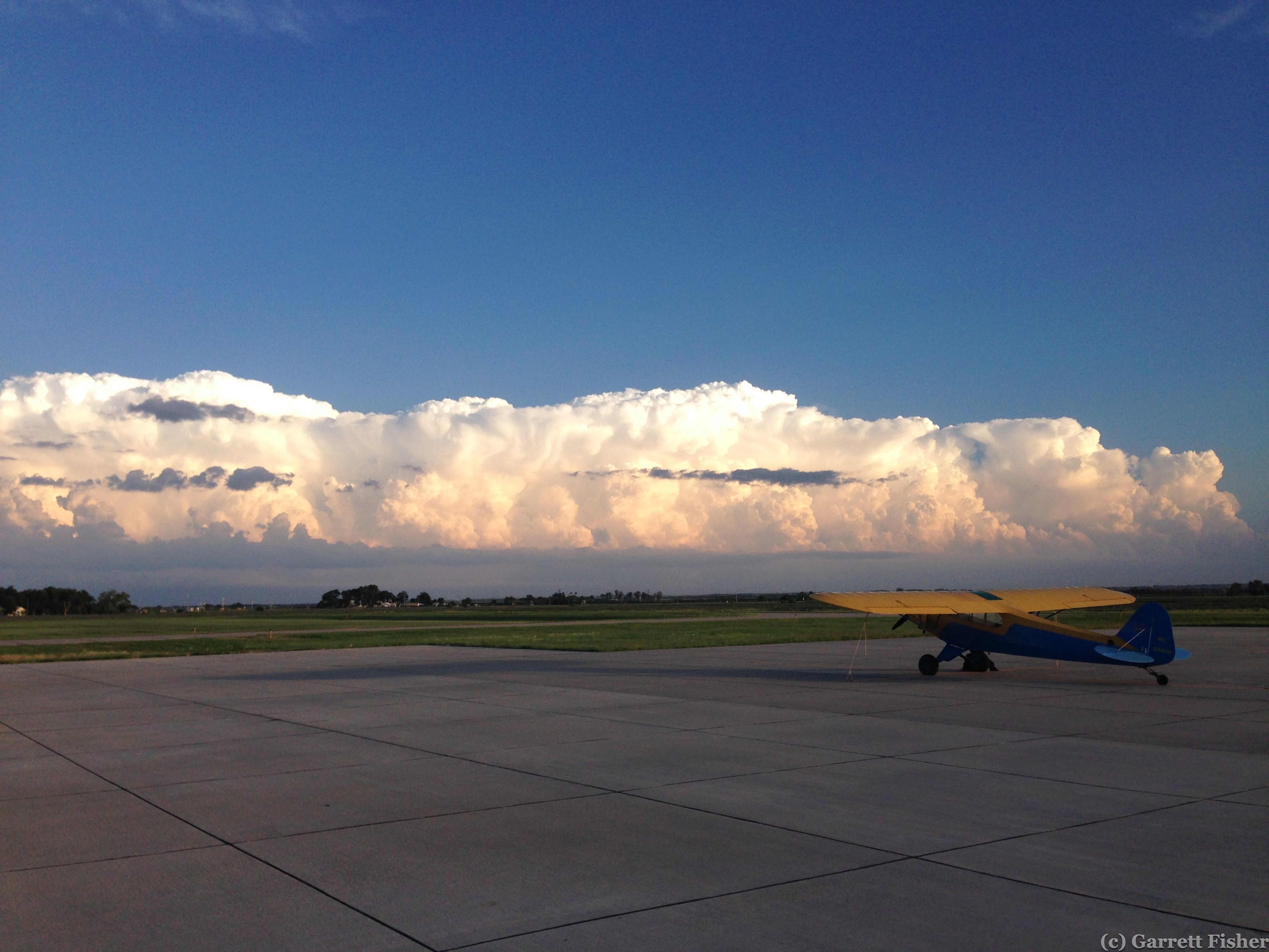
As I took off into the pleasant morning air, it was evident how nice the temperatures were and, like the prior morning I took off in, the air was very smooth. Cruising over the cornfields of Nebraska was quite enjoyable. It got even more enjoyable when I noticed my groundspeed: 92 knots. The airplane normally does about 70 knots with no wind, so this was translating into a 22kt tailwind, or 26 miles per hour. One knot is 1.15 miles per hour, a knot being the speed to represent a nautical mile. In other words, one knot of speed is one nautical mile per hour.

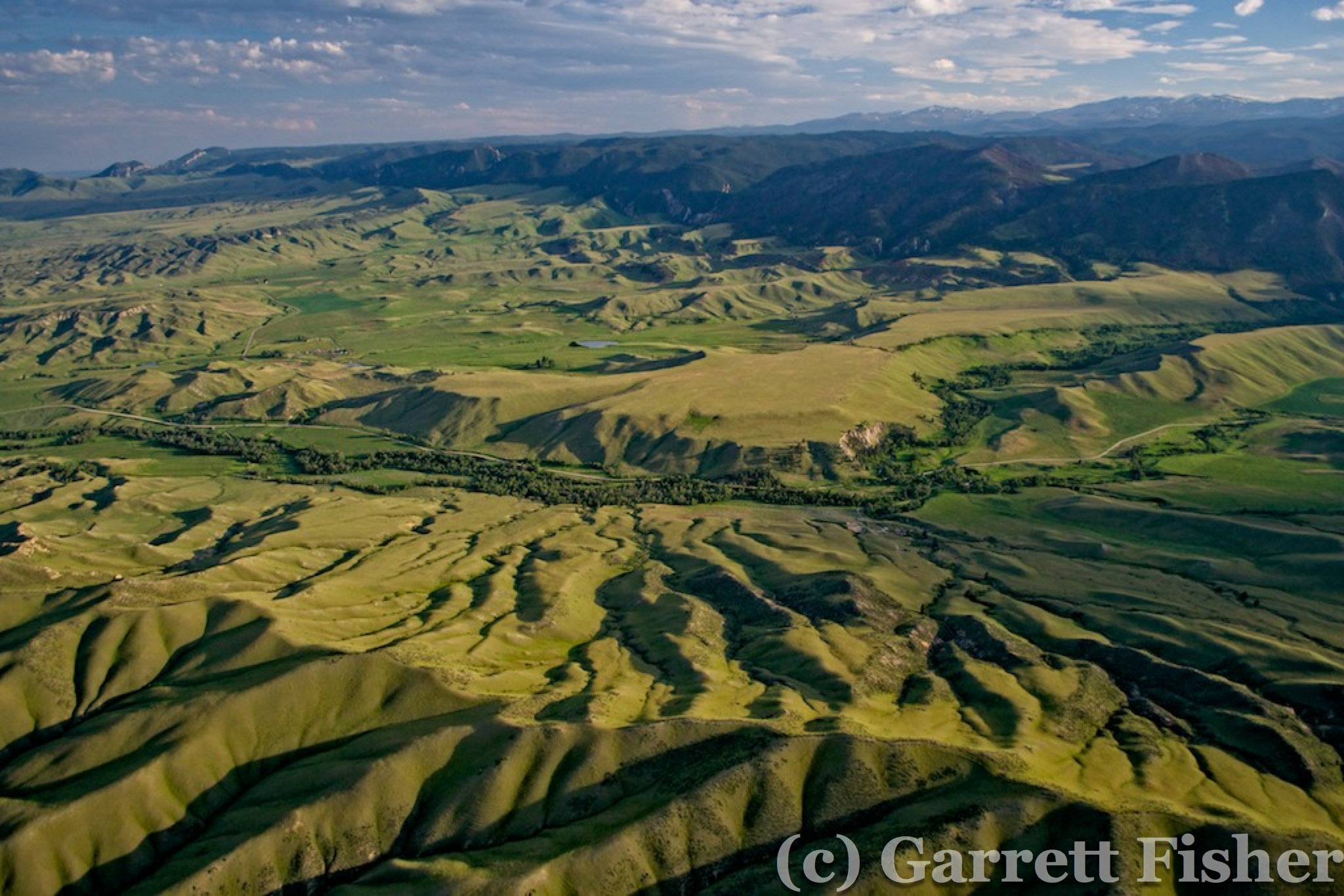
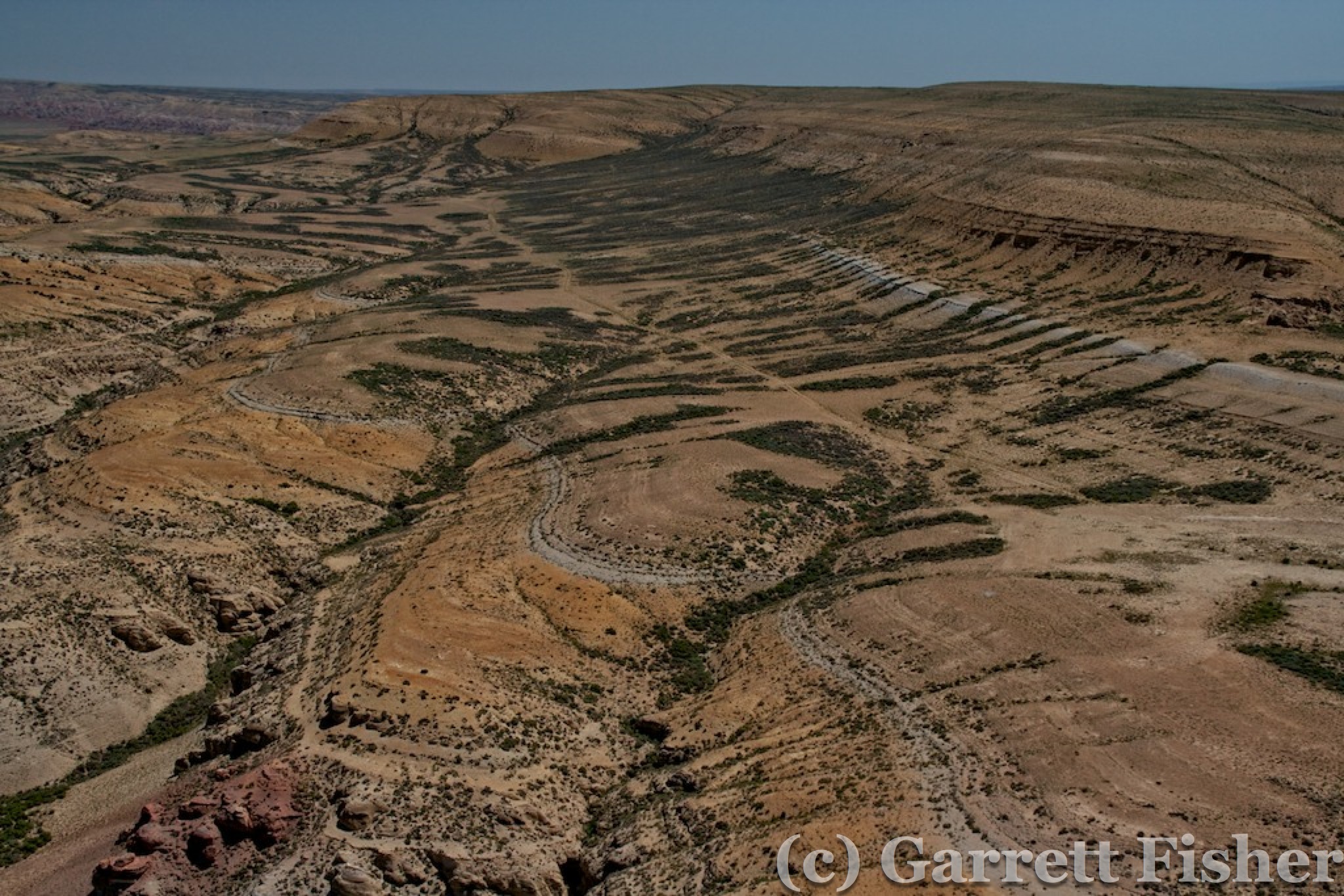
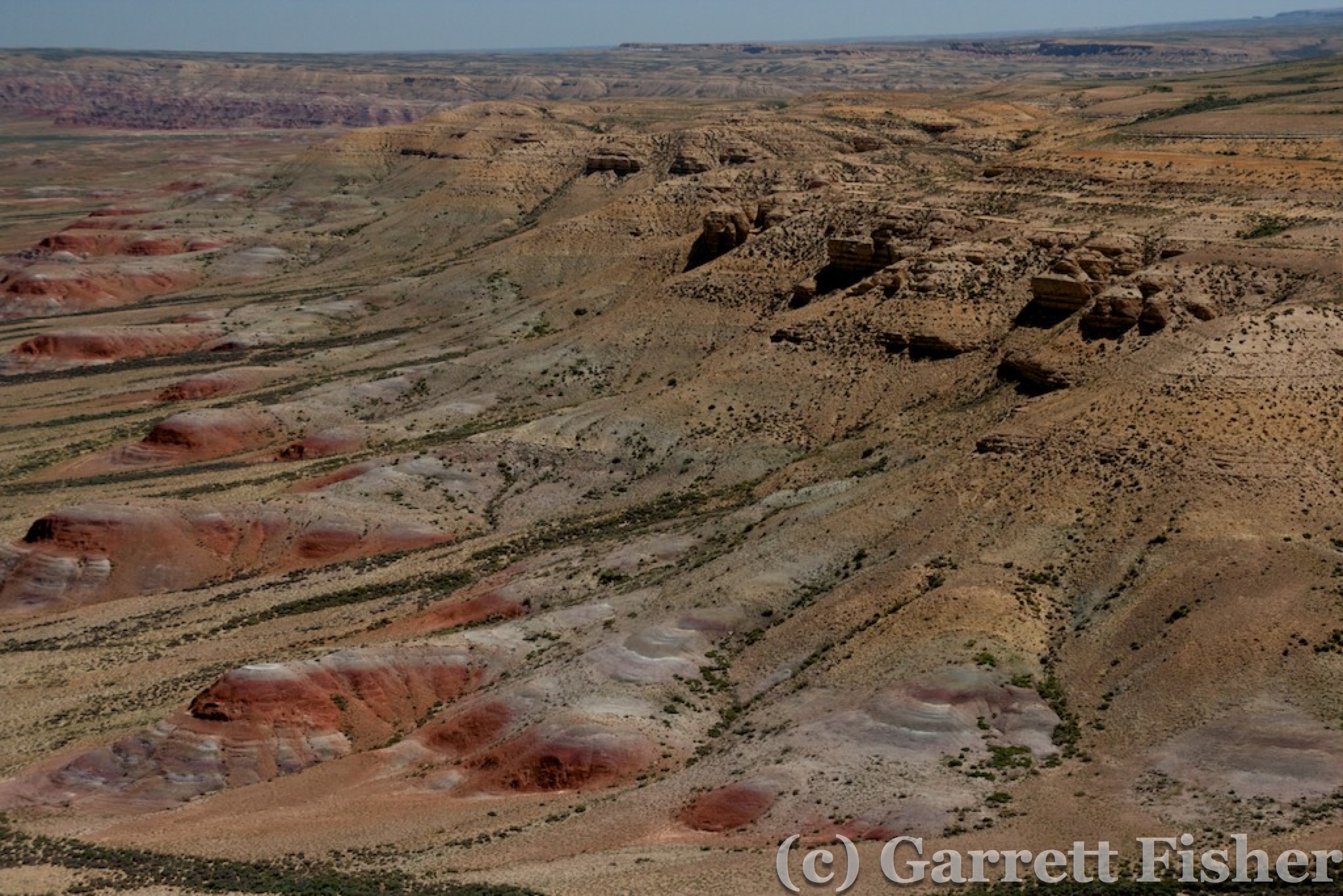
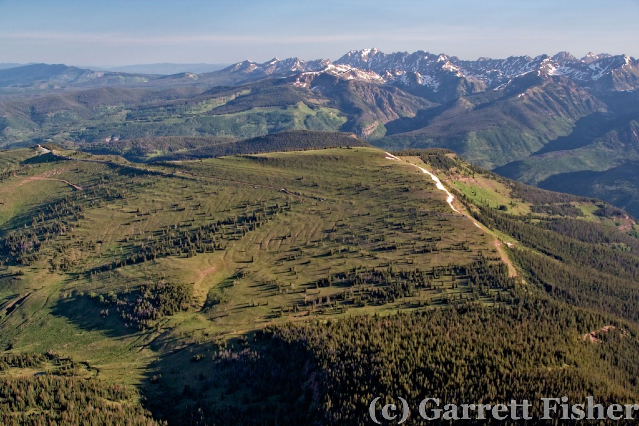
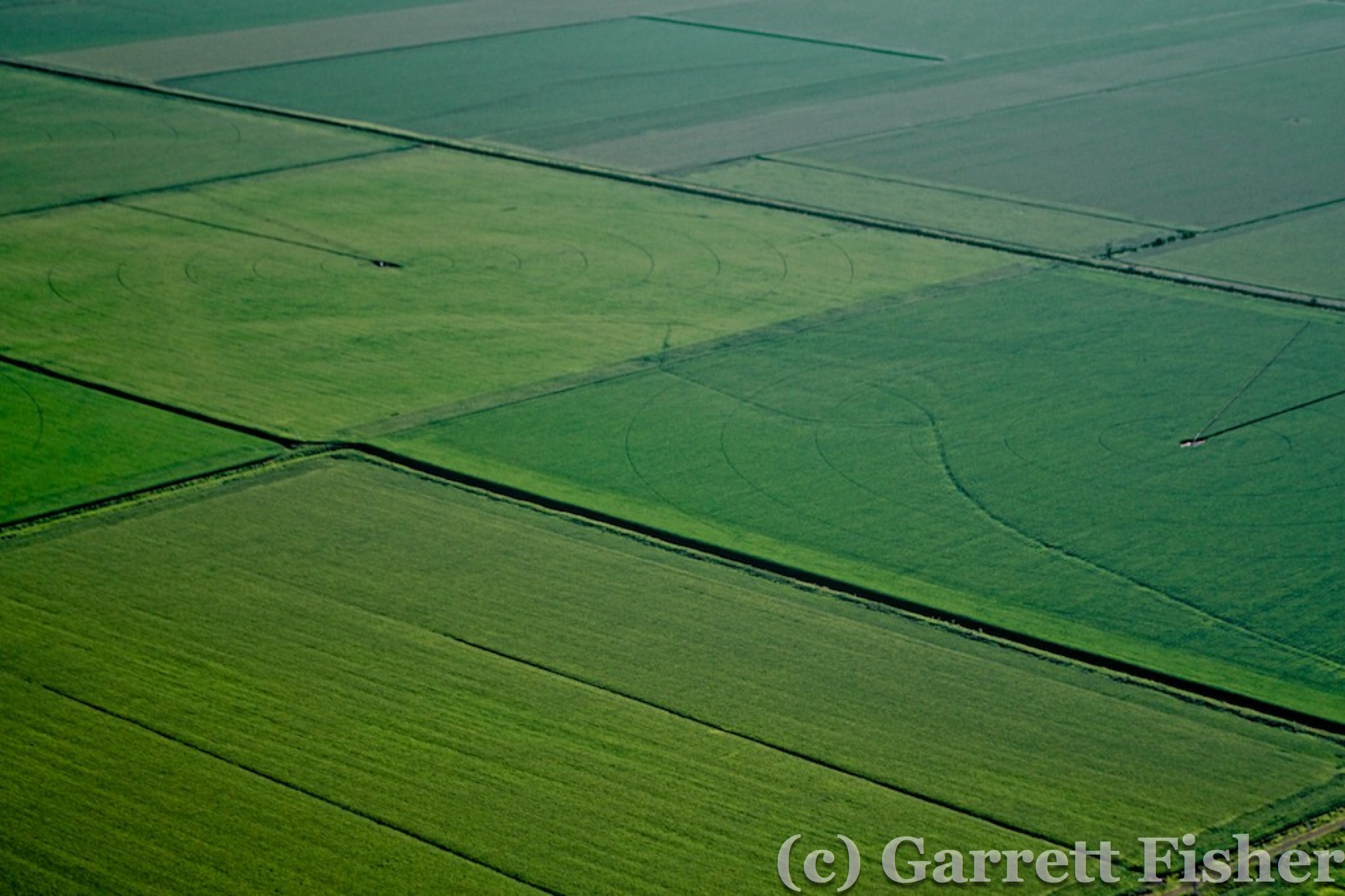
I enjoyed photographing quite a number of textured fields as I flew. It’s a project that I am working on, documenting farm fields from above. The textures are worthy of an art gallery, amazing features of art that appear dull on the ground. It gave me something to do absent epic and deadly terrain to fly into.

Farm Field Texture
Textured Farm Field – Nebraska

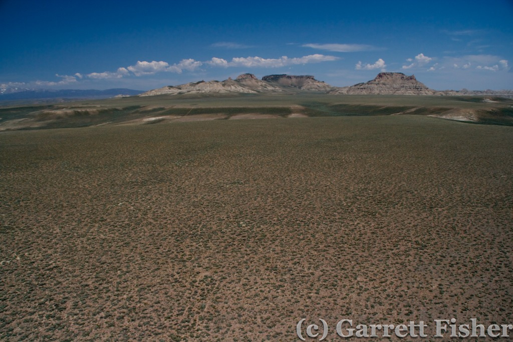
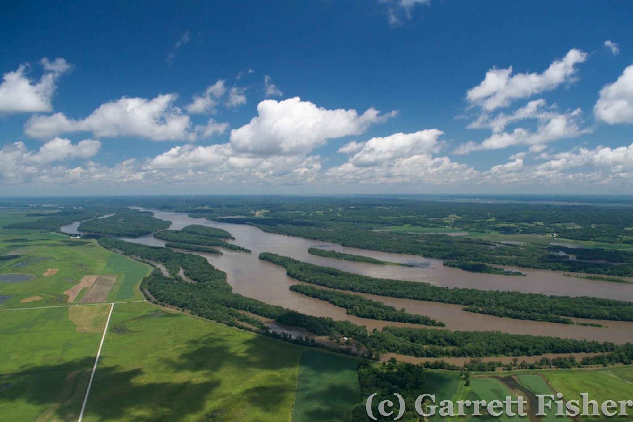
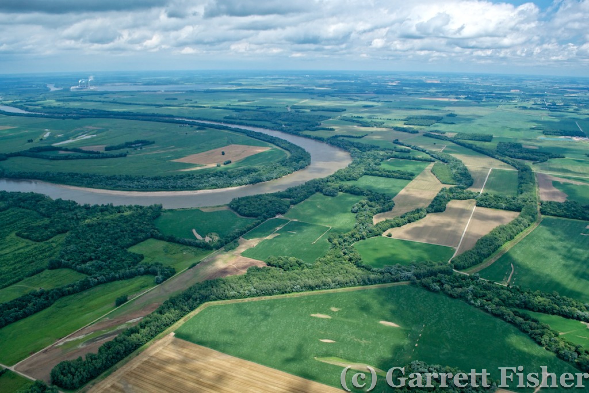
About 2 hours into the flight, I came up to what looked like a sizable river. I assumed it was the Missouri, and my iPad confirmed it. As I approached, I looked at the state lines and realized that I was about to fly over a shred of Kansas! Gasping, I steered the airplane 30 degrees left, to avoid a one-mile incursion into the “reservoir of bad ideas” (ref. Paul Krugman, economist). I don’t like Kansas and, if I can spitefully avoid flying over it, all the better.

Missouri River
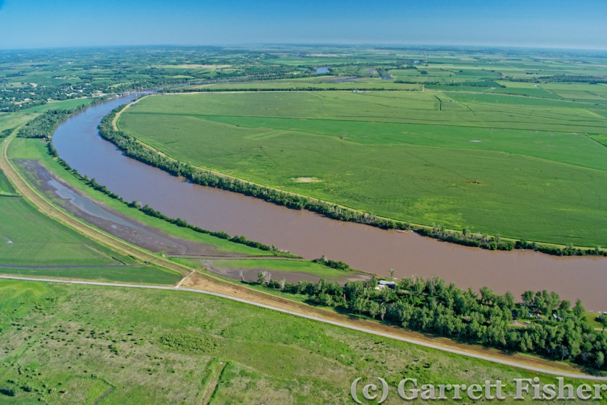
Missouri River – Just north of “Reservoir of Bad Ideas” (Kansas) – NE/MO Border

Farm Field Texture - Missouri River Valley
Farm Fields in Missouri River Floodplain

Passing north of St. Joseph, MO, I landed in Cameron, MO to refuel. Three hours of flying and I was making incredible time. I realized at that moment that maybe, if the tailwind continues, I’ll make it to NC. Or worse, I’ll make it an hour from home.

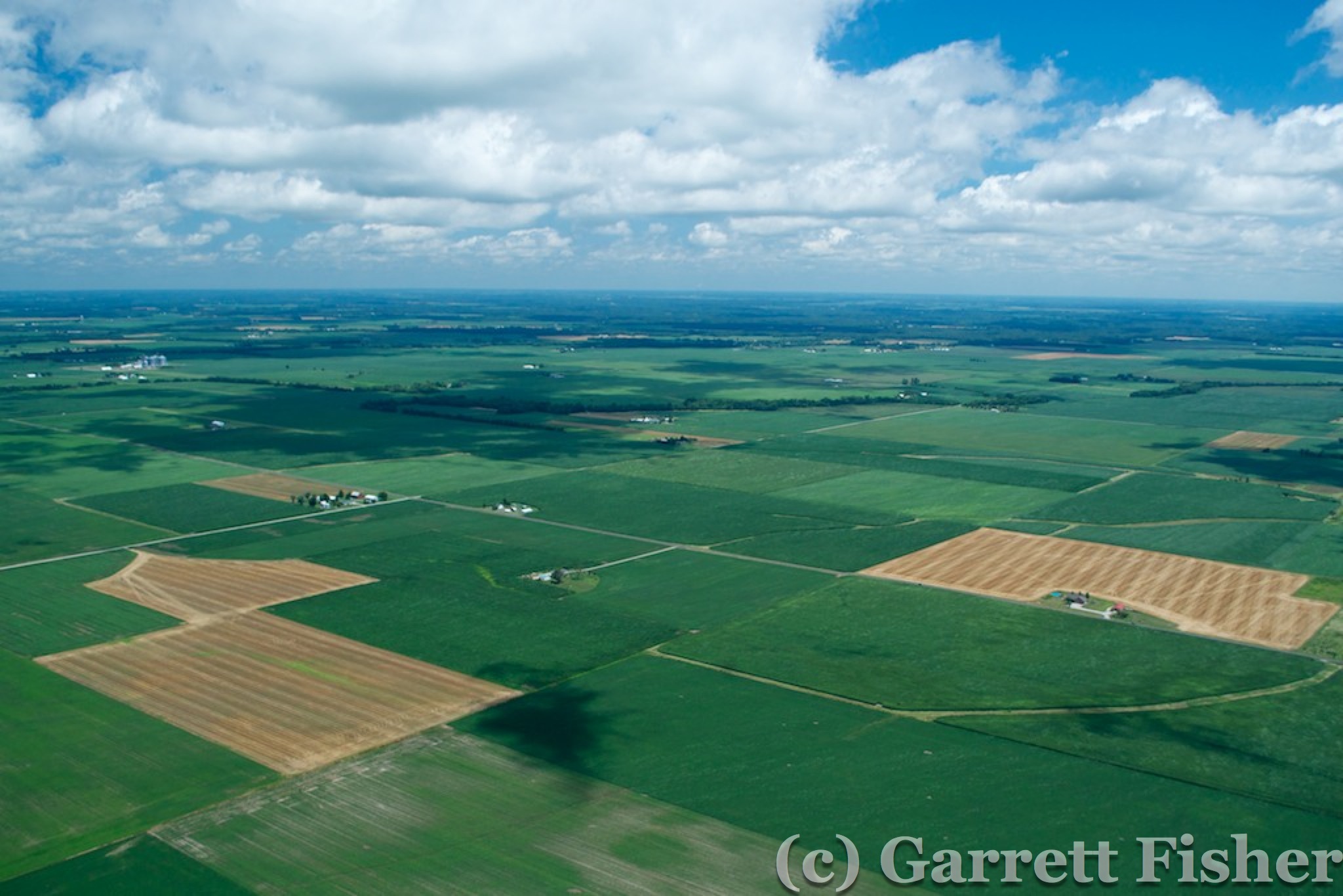
Pressing on, Missouri was quite green given recent rains, though it all looked the same. Two hours later, I passed north of St. Louis and crossed the Mississippi River into Illinois. The fields took on a more square structure here. Tailwinds continuing, I landed in Greenville, IL, thankfully on a grass strip that crosses the main runway. The grass strip was straight into the wind, which was blowing quite strong. With the headwind and resistance of grass turf, I was able to set the plane down and turn off in 500 feet, for a quick fuel stop.

Mississippi River
Mississippi River – IL to Right, MO to Left

Illinois
Illinois

A check of upper level winds showed that they wouldn’t hold and likely would shift at the KY line. If I could get to 9000 feet, I would be able to keep a tailwind. So I tried to out climb the clouds, and it wasn’t working. At 4000 feet, I was at the bases, and they looked anywhere from 2,000 to 10,000 feet tall, so while that would be pretty, it would not help me out any. The tailwinds, in contravention of the forecast, were less at altitude. I descended back down to my routine of 1,000 to 1,500 feet above the ground.

Getting Above the Clouds Didn't Work
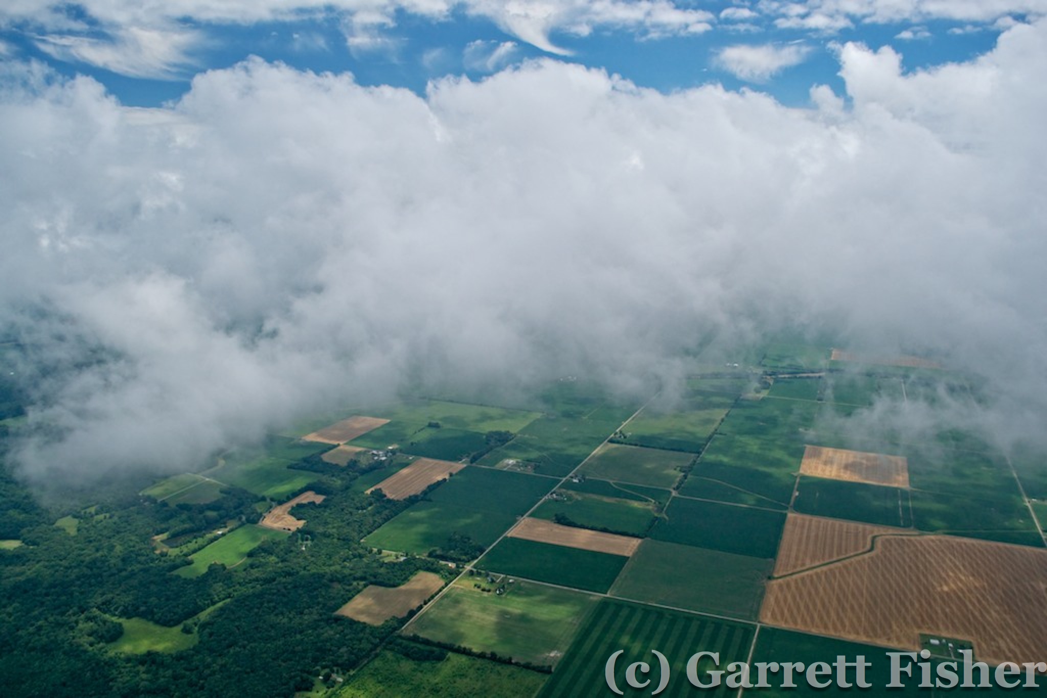
Above the Clouds Didn’t Work Like I Expected – Illinois

As I crossed the Wabash River, I noted a state line on the map. Indiana. I didn’t expect that. My line of flight took me into the state for 30 minutes, passing north of Evansville and then into Kentucky, crossing the Ohio River. My backup camera battery finally died north of Evansville, and that was the end of the photography. Fiddlesticks.

Wabash River, Indiana Border
Wabash River – Dead Battery – No More Photos for you! IL to the left, IN to the right

I got to southeastern KY, having crossed much of the “unbridled spirit” state though feeling quite bridled in a small cockpit, and attempted to refuel at Russell County airport. Dodging a strong rain shower, and performing the most insane landing in my life, with brutal crosswinds, I pulled up to the fuel pump. Some guy on a lawn mower yells “No fuel!” and drives away. Milling around trying to find a live human that will have a conversation, they confirm that there is no fuel, will not be until tomorrow, and it was advised via NOTAM. I snarkily advised that my NOTAM listing does not have the fuel advisory. Oh well. My fuel was quite low as it was, and I was not thrilled with having to do another stupid landing with that wind.

Since the wind was howling, it was only 10 minutes to Wayne County airport in Monticello. I landed before the paved runway in the field to avoid the travails of pavement, crosswinds, and tail wheels mixing. They actually had fuel there, so I ran like a madman to fuel up and make haste. The kind Kentucky folks were having some form of Board meeting at the airport, looking at me like I was deranged and stupid.

A check of the radar revealed bleak prospects. Not one, but two lines of thunderstorms were between me and Charlotte, though I was 194nm from home. Not bad given that I have been able to get up to 235nm out of a tank with 45 minutes to spare. I would get home tonight if I could get through, which I honestly didn’t think was likely. I was counting on the one-hour lifecycle of a thunderstorm to mean that, by the time I got to them, the lines would reconfigure and provide me a window.

I passed over into some terrain in Tennessee, with rain showers and lightning to the left (northeast) and some towering cumulonimbus to the right (southeast). As I passed over some quite pretty terrain in a national forest, I thought first of my impotent cameras and second, I AM SICK AND TIRED OF EXPECTING TO DIE IF THE ENGINE QUITS. It was 100% trees, no cell coverage, no roads, nowhere to land. Fortunately, that gave way to civilization, cell coverage, and clearings.

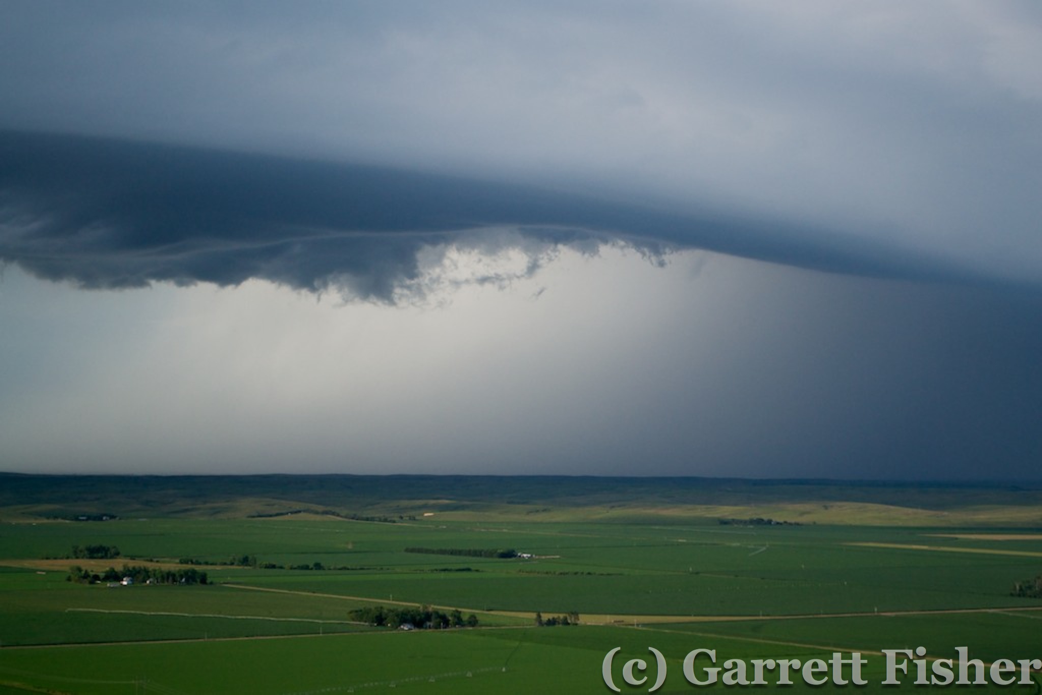
As I got into the Tennessee Valley, the sky was dark and rain was ahead. There were wispy low clouds, typical in the south after a giant rainstorm. I was concerned that they would sock in under me, as I was flying above them. Further analysis showed that they were on the move, and I would be all right. The bigger concern was the rain ahead and what that meant. There was a hole in the rain shield, with legal visibilities and cloud clearances in it. Radar finally refreshed with some cell coverage and, as I assumed, the line was converting into stratoform rains. The atmosphere had spent its convective energy, something I was hoping for as the front was expected not to make it over the Appalachians.

The rain was moving at a fast clip. It took what seemed like 30 minutes to catch up to it. Meanwhile, I had concern the hole would close on me. I tracked nearest airports in all directions – through the hole, behind me, even in directions I didn’t plan on going. If the situation got dire, I would need an escape plan. Fortunately, I was finally able to catch up to the line roughly over I-81. It was moderate rain at best with 3-mile visibility. Morristown, TN was my backup plan as I plunged into the precipitation.

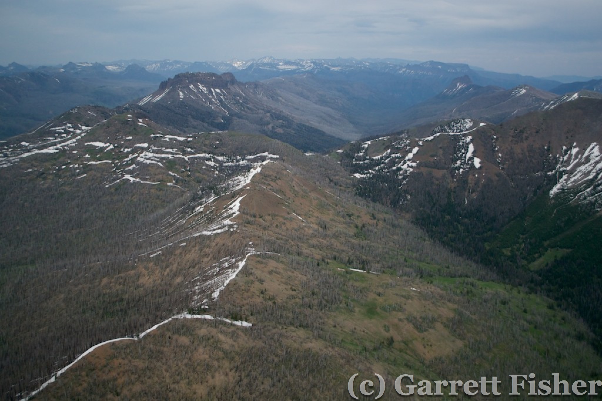
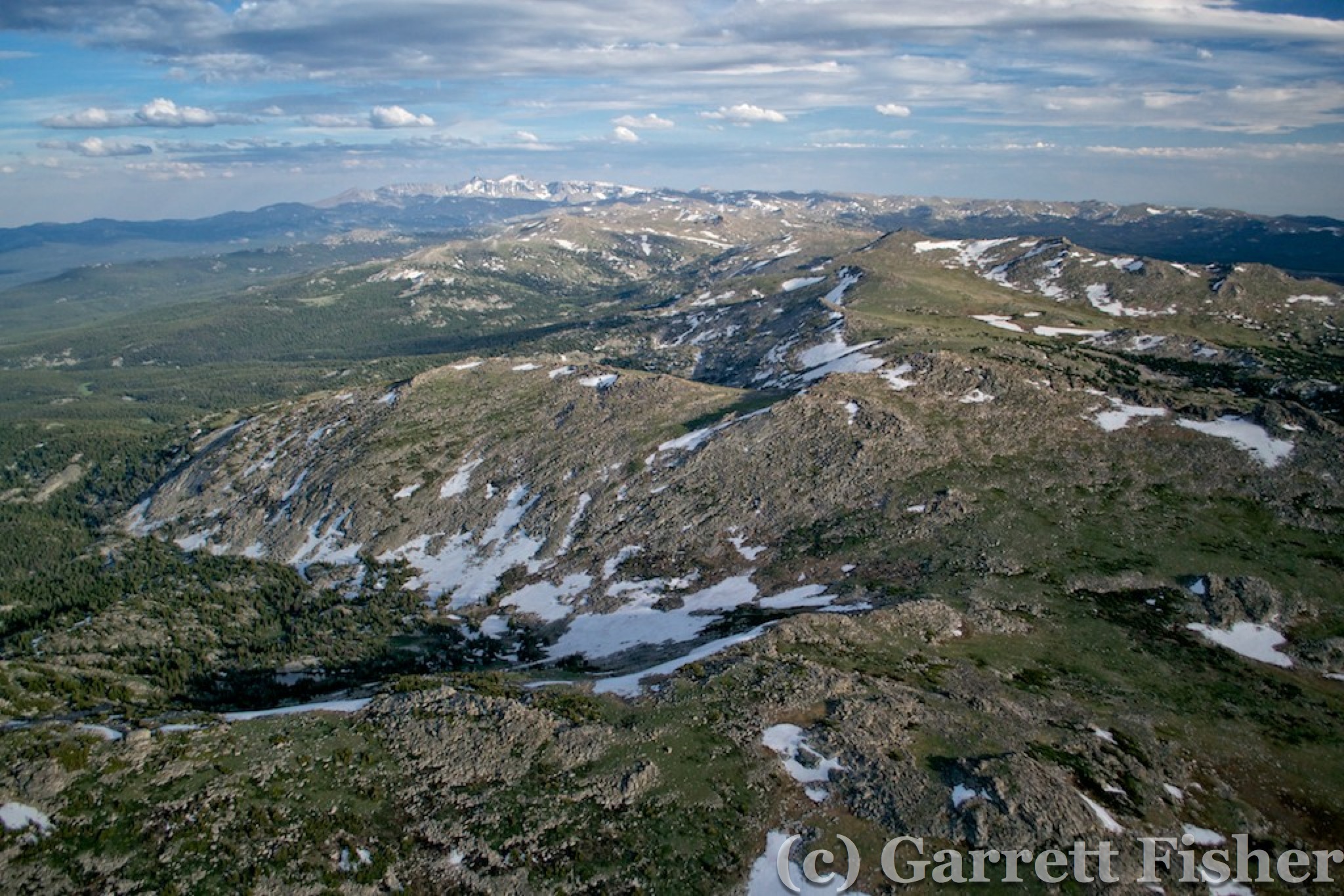
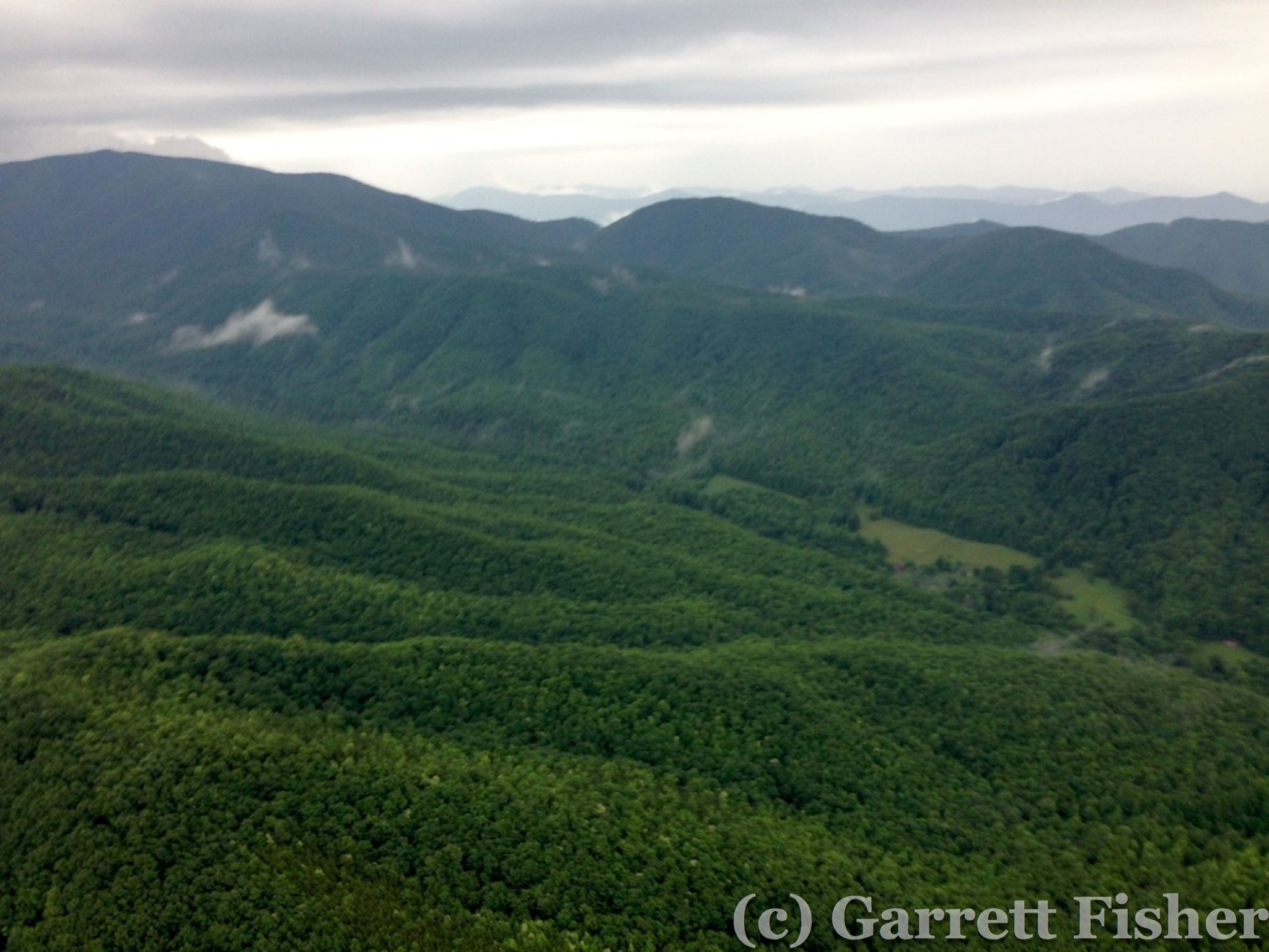
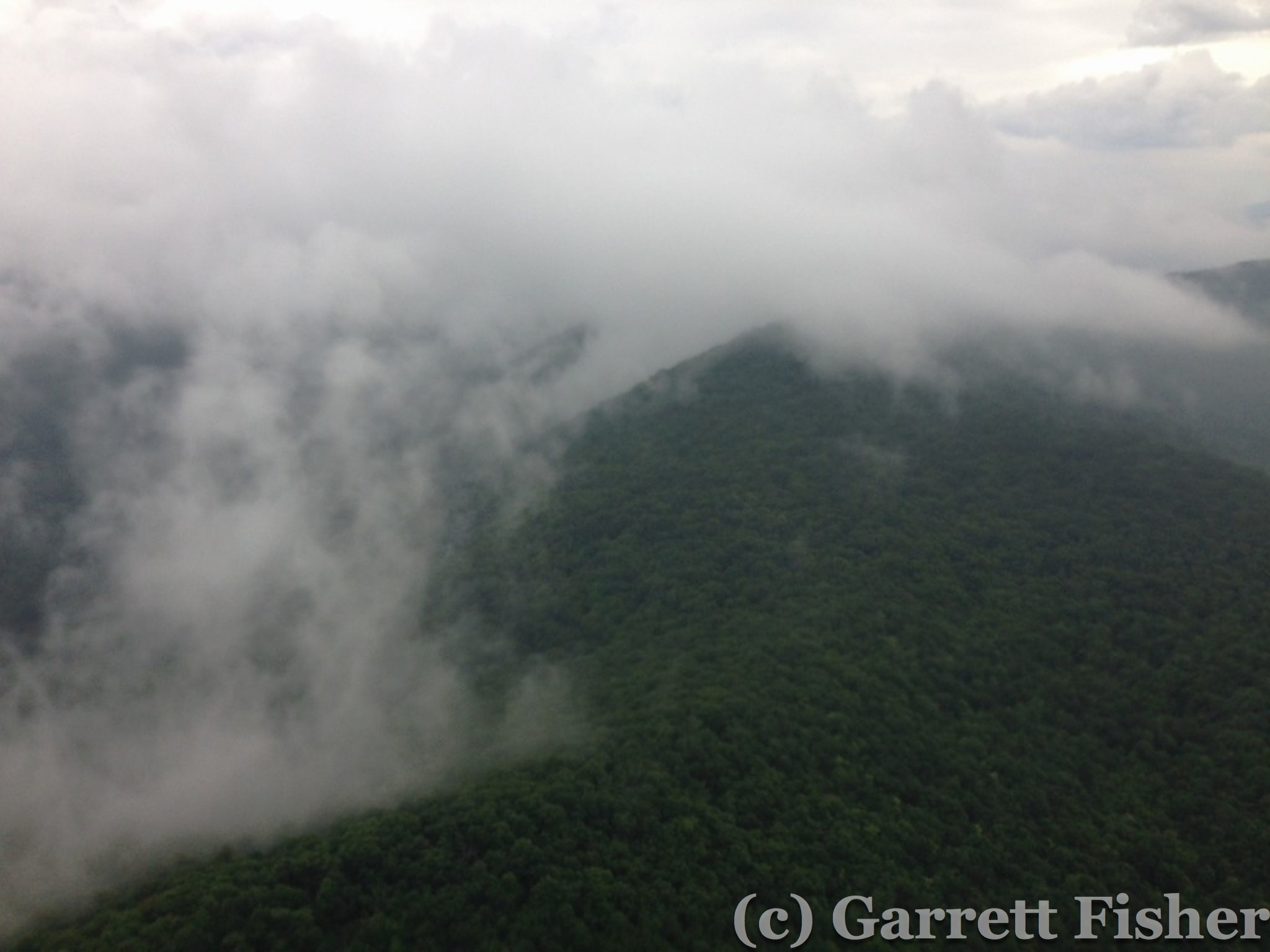
My secondary concern was the second line over the NC mountains.  What would the line do? What would the clouds do? My gut was telling me it would be fine, however the rain was not abating on the other side of the line and there were a healthy amount of low clouds, low enough that I knew they would be down over the mountain ridges. As I got closer, the low clouds abated and the NC mountains came in clear view. The second line was converting to stratoform rain, also losing its convective energy and potential. Now it would only be a matter of sufficient visibility given rain, fog, clouds, and terrain. I added power to climb up to 4,000 feet to clear the first ridge. I expected the mountains to look far more ominous, being reminded of many airplane crashes and sad stories due to flying in weather exactly like what I was doing. Colorado had changed me. These were hills.

NC Terrain, Meh
NC Hills – These can’t be considered mountains. Crummy iPhone shot.

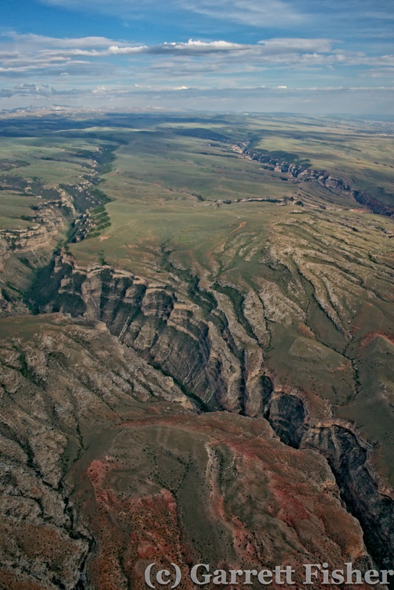
Once I got to 4,000 feet, I could see over the ridge. The gap in the stronger cells materialized as the radar had shown, a window of opportunity north of Asheville and south of Mt. Mitchell, the highest peak east of the Rockies at 6,674’. At this point, I will be damned if I have no photos of it to speak of, so I deleted some old pictures off the iPhone and snapped a few pictures. Between a full iPhone, dead Canon lens, and dead Nikon camera battery, I was pretty much out of photo options.

As I got closer to Mars Hill, visibility lowered in moderate rain to 2 miles in two quadrants. As such, I flew more to the north to remain within 1,200’ of the ground, thus remaining in Class G airspace with less restrictive visibility requirements. Class E was lower to the ground near Asheville (meaning visibility needed to be higher), so I had to stay away from there, even though it looked quite IFR, anyway.

Mt. Mitchell was shrouded in clouds, as were the rest of the mountains down to 5,500 feet or so. I crossed the Blue Ridge Parkway in a very wooded, beautifully green section, with very pretty clouds moving around the peaks to my north. I could see the Piedmont – and I will make it home – despite some lingering rain showers here and there. I texted the wife and the owner of the hangar than I will be in around 8PM.

NC Terrain, Meh (1)
The tallest mountain east of the Rockies is hiding in there. Ho Hum. North of Asheville, NC. iPhone shot. 

The remaining route took me on the south side of South Mountains State Park, the nearest mountains to Charlotte and the source of the cleanest water in the state. As I flew over this now innocuous terrain, I had the warmest, fuzziest feeling that I did it. I had just flown over 2,300 miles, 34 hours of flying time, and some absolutely stunning terrain and experiences. I had approached the adventure as a simple flight from CO to NC, with some added spice going to Yellowstone.  That is a tendency of mine, to get very literal about things – “its just a flight, what’s the big deal?” If I can piece individual pieces of a large project together, each piece doable in isolation with relative ease, then I mathematically transfer the ease to the entire project, and categorically only feel the “normal” emotions afterward. For example, when completing the final photo of the 14ers project (you’ll see the book forthcoming), it hit me how risky the whole thing was. Each flight and each mountain wasn’t so bad. All 54? In the winter? What the hell was I thinking?

Even better was the fact that I crossed one half of North America, in one day, in a Piper Cub! 1071 miles! That is statistically extremely unlikely if someone wanted to repeat it. The 20kt tailwind was 40kt at times, never less than 15kt, all day. The gaps in the weather were timed perfectly and opened despite forecast intentions. The trip was the longest I have ever taken, over some of the most interesting terrain (most of it very problematic if the engine quit). I had camped beside the airplane for the first time, interacted with 5 lines of storms, 3 time zones, 11 states, 7 mountain ranges, 3 national parks, 14 airports, 35F to 100F temperatures, ground winds to 30mph, a 26 hour mechanical delay, and altitudes to 14,000 feet (without oxygen). All of it was done with no radio, no lights, no transponder, a compass, iPhone, iPad, and a map. And it was AWESOME.

The best part? Within days of landing, our plans started to firm up that the plane will be heading very, very far west in the near future. It looks like my ass will take the shape of that airplane seat, after all. Stay tuned.

Filed Under: Uncategorized

Flight: CO to MT to NC: Day 2 & 3: Buffalo, WY to Lexington, NE

July 7, 2014 by garrett

The day began with a fellow pilot and his passenger happily conversing on the way to their far more luxuriant Beechcraft parked next to mine. It was 5:15AM, before the appointed time set forth on my rude alarm clock. I begrudgingly emerged from my tent, far more content that the overnight low was 60 as opposed to 35. Pre-flight preparations went smoothly and I was off before 7AM.

Unlike the prior day, the air was a wonderful sea of calm. With a morning sun not yet too warm, pleasant air temperatures, and a sea of undulating, textured terrain beneath, I was enjoying myself immensely. Easy photography, no wind or bumps and a pleasant drone to the engine. The plan of flight was to proceed north of Gillette, WY to Devils Tower National Monument, then southeast to the Black Hills of South Dakota, Mt. Rushmore, Badlands National Park, and the Sandhills of Nebraska. I did not know how far I would get, though I did look forward to the prospect of getting pretty close to home, quite possibly Tennessee.

Textured Terrain
Textured Terrain – North Central Wyoming

Undulating Terrain
Undulating Terrain – NW of Gillette, WY

The textured terrain was rather desolate, and I did have the whole subconscious tracking mechanism in full operation, though I had a calmness about it that I did not over prior terrain. The fact that it did not seem so hot, and it seemed less dry seemed to indicate higher survival chances of trekking in the wilderness. The undulation gave way to flatter terrain, which became progressively more covered in some very colorful yellow flowers.

Pretty Yellow Flowers
Colorful Yellow Flowers

Approaching Gillette, WY, Devils Tower came into view 40 miles away. I thought to myself “I really wouldn’t want to have to land out here, it seems it would be awfully inconvenient to deal with any issues.” A few minutes later, a sudden roughness materialized from the engine, accompanied by a 75 RPM drop. After a brief pit in my stomach, I scanned to see that there were about 4,000 places to safely land, and focused on the RPM. It was holding with no continued degradation; therefore, altitude would hold. I checked the GPS – 24NM to the nearest airport. I texted my wife the situation as I had cell reception and figured I would not if I had to land in the middle of nowhere.

More Pretty Yellow Flowers
Engine Roughness, NE of Gillette, WY

The roughness was mild and consistent. I figured it was likely an exhaust valve given the behavior of it and some of the recent characteristics of the engine. Small engines of this kind with low time since overhaul can develop excessive carbon on the valve shaft, which accumulates and sticks to the guide, which is an extremely tight tolerance. Worst-case scenario, it sticks fully open, and the RPM drops to an amount that just barely supports flight. Not ideal, and not deadly, either – so no need to do something silly and make the situation worse.

As I approached Devils Tower, I kept the position reports up by text message, and enjoyed the fact that I was able to actually still see it – as the direct-to-airport trajectory took me within a few miles of the monument. I was remiss, though, that there is a notice on the aviation map loudly indicating “For reasons of national welfare, pilots are requested to avoid flights within 3nm of Devils Tower National Monument.” Those usually have to do with government facilities and I thought: “How stupid is this? I come this far for some stupid passive-aggressive rules.” It turns out the site is very important to Native Americans and is also highly popular to pilots, so some courtesy was in order.

Terrain Getting Greener
North of Devils Tower National Monument WY 

Devils Tower National Monument

I was able to get some shots of the monument, reminded that 200mm would have been nicer than 55. Nonetheless, the area was getting greener and quite pretty and despite the massive inconvenience now imposed on my plans, I was enjoying myself.

I decided to research the facilities of Hulett, WY airport from my iPad. Bleak. No fuel, no car rental, no hotels, no airline service (ha!), no mechanics, nothing. It was effectively a safe haven in the event of….say…engine troubles, yet would provide little more than some pavement to look at when I got to the ground. Considering that I would have had to beg a local to drive me 50 miles to get a rental car to drive a mechanic there, the whole situation was as inconvenient as it could get. The engine improved slightly over the last 24 miles, and Spearfish, SD was 35 miles ahead. I opted to proceed and texted my wife. Other than an 8-mile desolate stretch, the route would follow I-90 and be abundantly safe when it came to places to land. Worst case, what I would have had to do in Hulett, I could do in some farmers field, closer to civilization.

The flight to Spearfish was uneventful. I kept the RPM up until final approach, in the event the valve got stickier and I had to glide in. No problems. Talking with the folks at the FBO, they had a mechanic that could fix it…and he was camping. He’ll be in tomorrow. It was Sunday morning at 9AM. So I was looking at a 26-hour delay, minimum, which I knew would cause weather aggravations in the east. So be it, at least I am somewhere very cool, just north of the Black Hills. They were an agent for Enterprise, so $57 later, I had me a nice Ford Fusion leather-clad rental.

I headed SE on I-90 (ironic, given that I grew up in NY near I-90) toward Rapid City to get something from Starbucks. Then I went out to Wall, SD to Badlands National Park. The only thing I was remiss about was that my wife was not with me, as we have meant to do a pilgrimage to this area at some point. Badlands was very pretty, with an abundance of those yellow flowers against the rock features. Air temps were 90, with 100 on pavement per the car. However, when parking over some of the rock features that comprise the badlands, the car quickly reads 120. It was extremely hot climbing on those rocks. I still had to get photos, so drenched in sweat or not, I enjoyed myself thoroughly.


Badlands 2

Badlands 1

Badlands 6

Badlands 7

Badlands 8

Badlands 9

Badlands 3

Badlands 10
Badlands National Park (Obviously from the ground)


Next up was Mt. Rushmore. I got there a bit later in the day, and that meant poor lighting for photography, though it was very pretty. I like the Black Hills a lot, and, believe it or not, I like Rapid City. I don’t like many places at all and it seemed that the whole Black Hills + Rapid City complex reminded me of the Front Range of Colorado, except without 2 million excess people. Many native or former Coloradans will note that “Colorado is not the Colorado I grew up in” and I think I can now understand what they mean. There is a certain peace and beauty standing at Mt.  Rushmore overlooking the plains to the east, and that is lost at an overcrowded park overlooking smog in Denver. Much like the changes in California over the past century, the population is just too much in CO.

Mt. Rushmore is a very interesting place. People of all walks of life were there, including many foreign visitors. It seemed that the design of the monument leading up to the sculpture and the management of the grounds casts the experience of noble ideals. Rather than touting American supremacy or how right the U.S. is, it seemed to just exude the noble ideals that the U.S. has tried to represent at times, ideals that can’t be contained in a nation and owned by it, only stewarded by one and hopefully many. It was ironically a non-political experience, if such a thing is at all possible. I thought it was quite tasteful and well done.

Mt Rushmore 3
Mt Rushmore 2
Mt Rushmore 1
Mt. Rushmore 

As I was heading to Sturgis to spend the night in a hotel (and shower), I was reflecting on how much I do like this part of South Dakota. I was here when I was 5 on a family trip – to both Mt. Rushmore and Badlands – and I was also there in March of this year on my long flight with my instructor for my commercial certificate preparations. It just seems to be a neat kind of place, with interesting people and interesting things to see and do. I was glad, in a way, that the mechanical delay happened there as it added an experience I could not have expected.

The airplane was in the air the next day at 12:30PM. Total repair cost wasn’t bad: $140 and involved disassembling the valve and cleaning it using some specialized valve tools. The weather had turned from bright blue sky to some thunderstorms and carrying precipitation. A strong cell had moved over the airport prior to takeoff and head down through the Black Hills where it fizzled, leaving low clouds over the range. I proceeded southeast over the Black Hills themselves, dismayed to find a moderate rain shower over Mt. Rushmore itself and the higher terrain. It was legal to get through them, given the visibility was over 3 miles and cloud bases sufficient, so I gave the airplane one heck of a bath. Photographing in the rain was interesting, as the lens cannot go out into the wind stream, or it will get very wet instantaneously.

Black Hills After Thunderstorm
Low Clouds, Black Hills of SD

Harney Peak, Highest Point in SD
Harney Peak – Highest Point in SD

Black Hills High Terrain in Rain
High Terrain of Black Hills, SD

Mt Rushmore - Aerial
Mt. Rushmore – Aerial

After Mt. Rushmore, I photographed the section of Badlands that is not developed, being accessible basically by foot. There were some interesting features, though also a totally remote area, again worrisome in the event of engine failure. The rain had caused all of the drainage basins to be flowing, and I am told that the mud out here is so bad that the most aggressive of 4×4 will get stuck until an hour after the rain passes. That is good to know in the event of landing.

Badlands

Badlands (1)

Badlands (2)

Badlands (4)

Badlands (3)
Badlands National Park – Aerial

South of Badlands, I was coming up on the back of a line of thunderstorms. It was proceeding NW to SE, so I arced around the west side of it. My plan was to refuel at Gordon, NE before traversing 110 miles of nothingness in Nebraska. The line of storms was barreling down on the airport, so my options were to land and hope no gust fronts came out in front during landing, taxiing, or refueling, then let the angry storm pass over ahead, idle back and fly slow until it passed, or proceed ahead. With a strong tailwind, I went into the Sand Hills.

Prairie Thunderstorm
Prairie Storm – SD

Dodging Storm
Prairie Storm – NE

That proved to be an aggravating mistake. 30 minutes into the Sand Hills, the tailwind became a headwind. There was no way I was going to make it to the other side. I diverted to the SW instead of SE, where the airport was 20 miles closer, though still way out of the way. Winds were worsening, and it was going to be too risky. So, in favor of intelligence and good aeronautical decision-making, and in obfuscation of my plans, I had to fly 30 miles west to Alliance, NE. I was not happy to find that, when I got there, I was west of the eastern border of Colorado, just 300 miles from Leadville, where I started two days prior!

Sandhills
Sandhills – NE

Alliance was sweltering hot. I got out of there as fast as I could and plunged into the Sand Hills, intent on making some progress actually to my destination.  Being in such a rabid hurry, I forgot to photo Carhenge in Alliance – a mockup of Stonehenge made out of junked cars stacked on top of each other! That is a deep regret, as I do not plan on frequenting this part of the country again. Nonetheless, there were highlights of the Sandhills as I passed over them. Being devoid of humans, houses, and roads, it had a strange beauty to it – not the same as the desert – its own flavor of desolation. That desolation required the continuous “How do I prevent dying if the engine quits?” civilization tracking mechanism – with houses easily 10 miles or more apart. I did fly over some Buffalo livestock, and it was really interesting to see that they herd like cats, spread out from each other, enjoying their personal space. Bovine cattle will often huddle near each other. Not the case with Buffalo!

As I passed over the Platte River, the area went from dry and crusty to verdantly green, with abundant cornfields. Rivers like this feed the groundwater, and irrigation was pronounced in the shallow valley surrounding the river. As I passed to the south of the valley, I got an answer to a lingering question I had about the plains. In Colorado, as soon as the plains give way to foothills, various evergreen shrubs and trees show up. I wondered if that was a product of nature, or of human use. Meaning that, absent humans, the great plains would theoretically have some sparse evergreen vegetation mixed with natural grasses, giving way to deciduous trees somewhere just west of the Missouri River. Here in Nebraska, in some form of natural preserve, evergreen vegetation showed up about as I expected it. The plains would probably be far less forlorn if found in their natural state.

Pine Trees in Nebraska
Pine Trees – Nebraska

The day was beginning to come to a close, and my desires to get very far were not going to be fulfilled. I was hoping to get to Kearney, NE, basically in the middle of the state with good hotel facilities. The forecast called for some nasty weather, and I wanted to stay in a physical building as opposed to a tent flapping in the breeze. As I passed Lexington and was within 30 miles of Kearney, some incoming thunderstorms were brewing with some nasty intensity. I checked radar on the iPad and they were growing rapidly, and it was evident that they would beat me to Kearney. So for the second time, aeronautical decision-making superseded my schedule and I turned back. Lexington would be the home for the night, despite the lack of hotels. I figured that the line moving through might be the only weather, so I would camp under the wing if it was raining.

Time to Turn Around
Time to Turn Back

Lexington NE
Lexington, NE Airport

Lexington turned out to be a nice little surprise. The little airport was a new building, with after hour access, a lounge, and a “napping room.” I set up shop in the napping room and slept for the night.


Filed Under: Uncategorized

Flight: CO to MT to NC: Grand Teton, Yellowstone, Central WY

July 5, 2014 by garrett

Just prior to arriving at Grand Teton National Park, the lens for my Canon camera broke internally. Needless to say, there was a 10 minute temper tantrum followed by a string of incredible cursing, another temper tantrum, more cursing, and maybe some more. I have a backup camera. In fact, it is newer and more capable except the lens is 18-55 instead of 18-200. I was about to reach the Mecca of my flying: Yellowstone, with geysers and a host of geothermal features, which require a close zoom to get. I was not happy, at all.

Jackson WY
Jackson, WY

To add to my gloomy disposition, the sky went cirroform overcast, which is absolutely the worst kind of clouds to photograph in during the summer. Haze increased north of Jackson, and I was very, very pissy. When the sky has white clouds very high up, the thickness of the clouds is not enough to darken the sky. Instead of a dark blue backdrop, I have bright white skies with usually dark green ground cover (trees). This makes for an either/or scenario, where I can meter for the sky or the ground, but not both. This made for some very technical workarounds given the fact that I was flying, had a less potent zoom lens and there was an increase in haze.

I found some amusement in the fact that I was just about to photograph Grand Teton National Park. The park got its name from some French guys, who called the place “Les Trois Tetons”, meaning “the three teats.” Americans later added Grand, which is awfully close to the French wording for “big.” I always thought it strange to French people, who would see Americans naming a park in such a funny way. Maybe to reverse things so they are understandable, imagine a park in France named by Americans called “Parc National Big Teats.” I recalled this at a dinner party in Germany two years ago, namely because one of the attendees was French. Her husband heard my fascination with the linguistic faux pas and stated “Big Titty Park?” So, I photographed Big Titty Park, from an airplane.

Grand Teton National Park

Grand Teton National Park (1)DSC_0063 (63 of 432)
Grand Teton National Park

The problem was, those titties were downright mean to the airplane. Winds were about 35 mph and were coming off the peaks, beating the crap out of me as I tried to photo. Between the meteorological punching bag factor, the overcast skies, increased haze, camera improvisation, and controlled airspace over Jackson Hole airport, I was not enjoying myself. If I saw something pretty, it made me even more unhappy. To this day, when I read up on details of the park, and see the immense stunning beauty from the ground with indescribably clear air, it exacerbates the temper tantrum that started with the broken lens when I flew through in some awfully dull weather.

Grand Teton abuts the south side of Yellowstone. Yellowstone had been a childhood dream to visit. When I was young, I would look at national park books and fantasize about visiting all of them, something I still do when I see pictures of places I have not been. Yellowstone was the Jerusalem of them all – and here I was with a broken camera and stupid weather. I was cranky.

To be honest, most of Yellowstone really doesn’t look that amazing from an airplane. Had the sky been crystal blue, with some fall color and fresh dusting of snow on the peaks, I may have thought somewhat differently about it. There are some notable differences between Yellowstone and the surrounding regions. It is remarkably flat, well treed, and there are quite a few large natural lakes. That combination of factors really doesn’t exist elsewhere in the west. However, those combinations, without the right lighting and color, are quite dull. On this particular day, it was quite evident the damage done by the 1988 Yellowstone fires, as large burn scars still remained. I understand why the place needed to be preserved as a park; it just wasn’t doing it for me from the air.

Not pretty
Yellowstone – Most of it Looks Like This

The situation got worse as I encountered various geothermal formations from the air. Absent the zoom lens, the photos were ho hum. Wind was howling, so I was getting knocked around a bit, and there would be nowhere to land if the engine quit. The combination was adding up to not be worth it. I was pouting.

Scalding Mudpits I can't zoom in on
Stupid Geothermal Features Without a Zoom Lens

I pouted more when I came to an area with lots of little geothermal features, all too small to make much in the way of art and imagery out of them. Oh well, I am here, might as well photo it. Then came Grand Prismatic Spring. I knew it would be neat from the air, possibly worth it, and when I saw it, it was stunning. Pouting/temper tantrum gave way to religious glee and merry making as I could barely fit the whole spring into the photo on 55mm zoom. Amazing colors and texture, something I have wanted to photograph from the air for years. This made it all better, not only better, simply worth it.

Blue Lake
Blue Lake Yellowstone – Near Grand Prismatic Spring

Grand Prismatic Spring
ANGELS SINGING! Grand Prismatic Spring, Yellowstone – Childhood Dream Fulfilled!

Grand Prismatic Spring (1)
Grand Prismatic Spring, Yellowstone

After Grand Prismatic Spring, there was nothing in the park worth photographing without a full zoom lens. My fuel situation was getting to be problematic if I planned on going anywhere far, so I opted for West Yellowstone airport, about 20 miles west. I flew in the direction of Hegben Lake, and recognized the terrain leading out of Yellowstone from an article I read, where a 7.5 earthquake in the 1960s let loose and a landslide killed some campers as well as sent 100mph winds down the valley. While Yellowstone is photogenic, someday the super volcano may destroy the atmosphere and kill us all.

It turned out the airport was in Montana. Fancy that, I knocked another state off the list. The only remaining ones to visit are LA, RI, VT, ID, HI, and AK. I wouldn’t mind all of them except Louisiana – silly state with Spanish-based law and the highest per capita Gonorrhea infection rate in the US. At any rate, I was too cranky to continue to Bozeman, so I crossed the park east and took the pass out along the US highway toward Cody. To be honest, the mountains were super dry and not appealing. Research has shown a prevalence of fires and even an F-4 tornado crossing the Continental Divide in 1987, though something about the whole range over there indicates that its just plain dry. The snow had mostly melted, yet there was no green grass, just brown and dead – not winter brown – dead brown.

East Yellowstone
Ugly East Yellowstone Mountains

Cody, Wyoming was remarkably dry and dull as was the valley to the east heading toward the Bighorn Mountains. I was still pissy as I was spending time and money for what again, exactly? To view ugliness? I took a photo, just for spite, to document the misery I was facing.  Instead of descending to view the terrain like I usually do, I hung out at 9000 feet so I wouldn’t have to climb back up again to cross the Bighorns.

Cody WY
East of Cody WY – Blech

The Bighorn Mountains looked like they sucked from a distance. Much like the mountains of Nevada, thousands of feet tall and still burnt dry, these mountains looked the same. The day was coming to a close and my intended point of stopping was Buffalo, WY, on the other side of the Range. Maybe I was just tired, I thought. Maybe its those stupid clouds and haze. Who knows?

As I got to the foothills of the range, I found some neat canyons. Ok, I guess I’ll get the camera out. The further I went, the clouds abated and air quality improved a bit. Then the terrain got interesting, showing that these mountains had character, a unique rock texture not present in Colorado or the Wind River Range. I suppose that is worthy of a photo. I opted not to cross the highest peaks, as I fatigued with steep mountain flying. In retrospect, I wish I would have, as I found out there is a glacier up there. Nonetheless, the thickness of the forest and the depth of greenery increased dramatically on the east side of the range. Desolation gave way to thick spruce forests, rock formations, and pleasant forest service roads with a perfectly spiced mix of campers enjoying nature. Water seemed to be flowing off the range, and the closer I got to the flatlands on the east side, it remained green. Dare I say it, it was quite beautiful.

West Side of Bighorn Mountains
Oh Fine, That is Pretty – West Foothills of Bighorn Mountains

Bighorn Mountains
Bighorn Mountains

East of Bighorn Mountains
East Foothills of Bighorn Mountains, near Buffalo WY

The descent into Buffalo, WY was textured and pleasing to the eye. Air temperatures were balmy but not too warm, and the approach into the airport was nice. At landing, an elk was running alongside the airplane, fortunately not in front of it. It took some time to find fuel, in fact, not until morning. There was a fuel truck and disassembled fuel apparatus, but no self-service. I eventually found a new self-service station in the morning, obviating the need to fly 15 miles north out of my way to fuel in Sheridan, WY. The airport was a bit of a ramshackle affair, with some adequate attention to pilot needs. Though unattended, the lounge door was unlocked, so I could wash up in the bathroom and leave my electronics for an overnight charge. I pitched the tent in the grass behind the airplane and went to sleep with the serenading sound of I-90.

Rustic Travel
Ghetto Lodging – Traveling in Style – Buffalo WY


Filed Under: Uncategorized

Flight: CO to MT to NC: Day 1: Yampa River, CO to Grand Teton National Park, WY

July 5, 2014 by garrett

The headwaters of any particular river are usually anticlimactic. While a river of some significant namesake may begin there, and while the waters are usually clean and unadulterated, that is about it. Sometimes the name is all that matters. In this case, the Yampa starts at the confluence of three other small rivers. In essence, it is the first place that the Yampa takes on a discernible characteristic as it winds toward the Green River and eventually the Colorado.

Headwaters of the Yampa River

I elected to photograph the Yampa as I am working on a book on the Upper Colorado River and its main stem tributaries. The rule for the book was that I would photo the Colorado inside the state of Colorado and any tributaries that started and finished inside the state. I completed that in prior months and developed some bit of debate on the Yampa. It starts and finishes in Colorado, yet ends in the Green River, not the Colorado. I opted to include it as I would be going over that direction anyway.

The Yampa winds north for a while, through two lakes, into the town of Steamboat Springs and then on through Craig and a host of other ramshackle settlements with little in the way of population. Twenty miles west of Steamboat and it turns into a burnt desert. Following this path, I eyed up my fuel and it was marginal to make it to Rock Spring, WY. I was intent on getting to Dinosaur National Monument and then north – and past Craig, there is nothing in the way of fuel. I could go past Dinosaur into Vernal, UT, though that would accomplish little as I would have to retrace east to meet up the Wind River Range. So I decided to proactively land at Craig, CO. Nobody was there. Fuel was not automated. No signs or instructions, except for posters advertising economic development. Morons – if you want growth, having fuel might help. Thoroughly annoyed, I took off and went back east to Steamboat’s main airport. With airline service, it is bound to be expensive.

Yampa River with Steamboat Springs
Yampa River with Steamboat Springs in the Background

Sure enough, it was. Fuel was $7.10 per gallon instead of $5.40, with a $15 “security fee” to pay for TSA services I do not use. $96 for half a tank instead of $48. So I spent double the cash and 40 minutes of extra time due to this whole stupidity. Markedly cantankerous, I decided that my plan sucked and I am not going to Dinosaur National Monument. The Yampa sucks anyway; its dry and it will be all the same all the way out there. I took a direct line to I-80 N/NW of Steamboat, with the intent to go N/NE to the Wind River Range.

I went over some ridiculously desolate areas, with such wide expanses between housing that I was concerned about dehydration having to walk 10 miles if the engine quit. I had 3 gallons of water, though I would have to carry it in the sun, hiking up and down over terrain, wondering if I was heading in the right direction. Not my idea of fun. It becomes an almost subconscious exercise, tracking the nearest dwelling in the event of engine failure. It’s not a lot of work to do as I am flying, though it emotionally gets tiring after a number of hours.

Colorado Desolation
Colorado Desolation

After about 80 miles of this desolation exercise, I crossed into Wyoming in an area 100% devoid of human life. I saw a bull or two as I passed over. As I was getting within a reasonable range of a road on the map, and within 30 miles of I-80, I noticed some activity down below and dust clouds. I encountered herds of wild mustang horses. I circled down, camera in hand, and I will say that the sight was stunning. Horses galloping wild and free, manes in the wind, dust kicked up by their hooves, just running. I had never seen anything like it – horses running in a steady gallop, going where they wanted to, with not a human for 20 or more miles. It was everything you can imagine it to be and yet more powerful, if not spiritual. These horses have a raw, unrestrained beauty when we take the rider off of them, running as they are meant to be. It’s a sight few in this world will see as I did, in real life and from above, seeing the herds coverage on their long gallop through the countryside.

Wyoming Desolation
Wyoming Desolation

Wyoming Desolation (1)
More Wyoming Desolation

There were a few baby horses running with them. Interestingly, they mostly run single file, and if there is a laggard, I saw one horse turn around, run back to the slow one, and run with his ailing compatriot. As they ran, horses were converging from a distance and the herd was growing. Right then, the entire experience was worth it – cost, time, and effort, even if the trip ended there. I thought of the naturalists who note that the horse wasn’t native here, were escapees from settlers, and don’t pass the scientific sniff test warranting preservation, yet Americans want them preserved anyway. This is why – those horses running wild and free on the range represent an ideal that we do not want to let die – something we may never personally get, yet it is that freedom that we all want. No wonder the public wants to keep them the way they are, and I can fully support it after what I saw. Even if it forever remains a symbol of what we cannot have, those horses need to continue to be running as a reminder of what we strive for.

Horses
Wild Horses

After circling a number of times and checking them out, I continued north content, with a big smile, and a warmed heart. My travels then took me over unimaginable desolation, dryness so barren that it begins to expose rock and textures and colors not possible where grass and trees grow. Crossing I-80 was uneventful except for some interesting rock quarries, which soon gave way to range again. Much like the entire west, this section of Wyoming changes quickly: from complete desolation to some basic greenness and sagebrush due to changes in soil, rock, and weather from elevation.

Texture
Wyoming Texture

Texture (2)
More Wyoming Texture

Texture (1)
And More Wyoming Texture

Sand Dunes

Sand Dunes – The Ultimate Sign of No Water and Death Lurking Below

It was back to the familiar routine of tracking how I would live if the engine quit. Housing disappeared except for some ranching roads, 20 plus miles from the nearest anything. Cell service is nonexistent. I have no airplane radio, so its me, my gear, and a long walk home if anything happens. Conversely, if the engine quits, the airplane will be fine as will I, because 95% of the terrain is safe to land on, it just might kill me once I get there. Its ironic how life works.

Over a butte south of Wyoming Route 28, I saw some more motion. This time it was a herd of wild elk, on top of a large plateau. While the horses engage in a majestic gallop, the elk first awaken from their slumber and sit up vigilant. As I got closer, they realized they were going to have to run (I don’t know why) and they wait until the last second to get going, running only because they feel they must. Mind you, I am not close to them. I doubt they see many aircraft.

Elk
Elk – Did I have to tell you that?

After the elk, it was more horses and then, to my surprise pronghorn antelope. These guys don’t wait around to get moving. When they saw my approach, they tore off at full speed, running in a quasi zigzag pattern, with the entire herd close together. It was amazing, in such a short distance, to see so many wild herds of animals of differing types, and to see their varying reactions to over flight of an aircraft. For the inevitable animal zealots looking for a victim to skewer, I have a very powerful zoom lens. While I did consider buzzing the hell out of them, I decided it was not nice, may or may not be legal, and would terrorize them anytime they heard an airplane cruise by and that simply is cruel. Despite my overarching kindness to wild beasts, there probably were hunters with guns hiding in the bushes intent on picking off these roaming pieces of steak. Ah, the joy of ethics debates.

Wide open Range
Range the Elk Were Grazing On – Oregon Buttes in View

After the wild herds, the Wind River Range came into view. For some reason, I have had a desire to see these mountains for a while. They jut southeast out of Yellowstone and rise abruptly and to dizzying heights. While not overall as tall as the Colorado mountains, they have a valley-to-summit elevation change exceeding most of what one can find in Colorado, are made of granite, and have evidence of heavy ancient glaciation. In fact, there are quite a few glaciers on them to this day, even though I did not get to see them.

As I traversed the dullness of the open range with Wind River coming into view, I later learned I crossed the Oregon Trail, somewhere near WY highway 28. Flying over these forlorn regions is hard enough on my mental tolerance, yet to think of crossing them in a wagon caravan, where death was common puts my inconveniences in another perspective. I wonder as I traverse these expanses what made them leave where they came from. Research has shown that many got duped as to the viability of the land they inhabited, that it was drier than they thought. Yet still, they were going into wilderness with roving bands of unhappy Native Americans and absolutely nothing when it came to modern conveniences. It was not as though there were just a handful of these folks; the entire west was settled with them. The irony is, I feel a sense of deep isolation even though the West has been won. It is now defined by empty expanses of desert where no one wants to live, even though we have modern access, national forests and parks where tons would live and cannot by law and yet would be filled with McMansions owned by the wealthy, and then the many cities and towns that are inhabited. Distance is strange to us because we pack ourselves into cities and suburbs like sardines, and create the visual and emotional connection that modernism can only come from such extreme density whereas the highest quality of life is in semi-remote counties near epic natural beauty coupled with ostentatious housing. Nothing is there other than what these people need, and they have the most modern of accouterments possible. Instead of such density providing such conveniences, its how we pay for them and ultimately, how we put up with each other in the process.

Oregon Trail went here somewhere
Oregon Trail Went Here Somewhere – It Makes Me Want to Go on a Wagon Caravan

Wind River was as amazing as I thought. The range obviously gets lots of snow, so it is well watered. Soil is hard to come by, so sheer granite is exposed, with a texture far different than its cousins to the south. It is more of a mountain range that I personally hoped for when I moved to Colorado – something raw, defiant, uninviting, and a symbol of individualism. Yet to the individualist that makes his or her way into the range, there are wonderful alpine lakes, glaciers, trees, and abundant water waiting for them. There is evidence of seasonal dwellings built by the Native Americans, for summer hunting escapades. The Range to me is a symbol of a place being off limits to all except the adventurous, and I feel a strange sense of home, even though the place would be remarkably difficult to live in, were it not for conservation laws prohibiting it altogether.

Wind River Range
Approaching Wind River Range

Wind River Range (1)
Wind River Range Awesomeness

Wind River Range (2)
Wimps not Welcome – Wind River Range

Wind River gave way to a fuel stop in Pinedale, WY. I learned there that the Bureau of Land Management uses airplanes to move the horse herds around to prevent overgrazing. Hence, they likely thought they were about to be moved and therefore converged to stay together as I overflew. I also learned that this section of Wyoming, an hour from Jackson suffers from Texans (as does Breckenridge) and Californians wishing to play with their toys in the wilderness. It makes for an interesting brew when these kinds of people come out for limited periods, purchase property, and wonder why Wyoming is nothing like California.

Pinedale to Jackson was relatively uneventful. A continuation of the extended Wind River Range converged with other mountains around the tight entrance to Jackson. We had once fantasized about living there, thinking it would provide what Colorado did not, and a quick over flight told me it did not. Maybe back in the day when tourists are not measured by the millions, invading small villages that cannot expand due to national parks and forests, would I have loved such a place. Now? It is another Colorado, a retail wilderness burdened by expense and high visitor counts, offering a taste of the mental freedom I am looking for while drowning it in visitor count. It was eye opening to see that the demographic of hyper tourist towns is largely unsustainable, and I wonder what the future will hold for the idea of balancing nature with sophisticated society. Has our conserved lands policy backfired in a strange kind of way by bringing too many people to nature? Time will tell what specific management mistake we have made.

Mountains near Jackson WY
Mountains South of Jackson, WY

Filed Under: Uncategorized

Flight: CO to MT to NC: Day 1: Leadville, CO to Yampa River Headwaters

July 5, 2014 by garrett

Sleeping on my glorious mattress proved to be far more comfortable than masochistic camping trips of the past – with rocks jammed into my rib cage or hip. Though while actually sleeping on a 21” wide inflatable mattress, I couldn’t help but have feelings of personal victimization and endurance until I pulled the plug on it in the morning to compare the difference. As I lay there with the mattress deflating, the hard ground was like a bed of nails compared to the silk pillow I was just sleeping on. By far, I recommend anyone camping spend $100 and get one.

It took some time to get to sleep given the orgy of patriotism and burning of fireworks (do most know that the antagonist culture of the US, the Chinese, invented fireworks?). I finally got to sleep, only to be awoken at 3AM freezing my ass off. A quilt is NOT enough to ward off 35-degree temperatures. I doubled up the quilt and sucked my extremities in like a turtle to be able to get back to sleep. Of course, once peacefully dreaming, the alarm bitch slapped me in the face at 5:15 AM.

It was one of those mornings filled with energy and anticipation. At that hour, one can feel the animals, birds, and wind waking from its rest with the rising of the sun. Had I been the next valley over in our house we used to live in, I would have felt nothing of the sort and snored on until 8AM, then complaining about the brightness of the sun while walking our over-eager dog for his requisite mile long defecatory waddle.

Morning Anticipation
Morning Filled with Anticipation – Mt Massive & Mt Elbert (highest in CO) in Background

I broke camp, packed everything up, ate trail mix and pulled the airplane out of the hangar at Leadville for one last time. I cranked the prop through and she started on the third turn as usual, with a little cold weather begrudging. After about 8 minutes of idle warming, I taxied down to the end of the runway, and had to wait for a couple of powered parachutes to take off in front of me – fellow campers who enjoyed a night of sleeping in $60,000 fifth wheel toy haulers – replete with heat, leather furnishings, and king size beds. I converted my sheer envy to hate as I waited my turn. Not everyone can purchase $60,000 toys for occasional use, but we all can hate to make up for it.

I took off at 6:51 AM and noticed that the Rocky Mountain air was remarkably still. No wind. No bumps. Then again, I don’t ever go flying at this hour, so I wouldn’t know. In the lack of wind to create mountain updrafts, it is challenging to get altitude with full fuel and my ghetto rigging of luggage, so I circled east of the airport to get up to altitude to head about 6 miles away to Mt. Sherman.

I had thought I got photos of all 54 mountains over 14000 feet in Colorado for a book I was working on, except I realized I did not have a good shot of the CLOSEST ONE TO THE AIRPORT. It can be very difficult to distinguish a 13,950ft peak from a 14,025ft peak right next to it, so my protocol is to shoot a ton of pictures of the range and sort it out later. Well, they all sucked for Mt. Sherman.

It turned out to be a good thing that I missed Sherman, as I would have had a book with no bare rock exposed shots of any 14ers. Being covered in snow is the natural state of these mountains, though for three months, they are melted off and accessible. The texture and terrain details are remarkably illustrative of the character of the mountain, so a few without snow would be good.

I found a hiker at about 13,500 feet hiking along a ridge and it struck me as a beautiful sight. Instead of bare rock and unforgiving terrain, it was a sign of individualism that this person was 2,000 feet above timberline, by himself, at 7AM walking a ridgeline. This has to be one of the most redeeming parts of Colorado culture – the fact that no part of the state is off limits – and mountain climbing is as normal out here as a morning jog in the vileness of suburbia is to eastern cities. I gave him a wing rock to signal my approval and camaraderie – and he just stopped and had a look as though I was drunk. I have been told that Coloradans get very pissy if someone introduces the droning sound of an aircraft engine to their wilderness journey and are liable to call the FAA and spew a tirade. Too bad for this displeased nature zealot, I was flying within the confines of federal law.

Mt. Sherman struck me as being remarkably easy to hike. The incline is basic. There is no technical component to the hike – merely walking – and there is nowhere to fall to your death. Climbing this mountain is simply a question of preparedness for the elements, stamina and endurance, and the desire to do it. It’s not the wilderness people ignorantly and dramatically make it out to be though the enemy to be overcome is one’s own obesity, arbitrary fears, and laziness.

Mt Sherman
Mt. Sherman

After Sherman, I went 10 miles north to Mt. Bross, the second of two 14ers I stupidly failed to photograph. Bross is about halfway between Leadville airport and where we used to live, so that is further confirmation of my own retardation. Bross is another mountain that looks very easy on the technical front. It amazes me the amount of death and search and rescue operations that occur – as these mountains are relatively close to services, not that severe, and with half a brain, death is not at all necessary (there is a chapter in an upcoming book called “Near Death Experiences” that will recount my own flirts with death in Colorado, so that flies in the face of what I just said, or I don’t have half a brain per my own assessment).

Mt Bross
Mt Bross

After Bross, a turn to the NW in the direction of the headwaters of the Yampa River took me near Quandary Peak. Quandary is the only 14er in Summit County, and is the closest to our former home in Breckenridge. The original pilgrimage to Colorado in 2005 with my friend Kyle involved making quite the stir over the name (he has a fetish for elaborate words beginning with Q). That, and my presence in the state was a quandary in and of itself, pining away for million-dollar rustic cabin lodging, unemployed, and with no hope to find a job there to support such out-of-balance pricing. Since then, many of my hikes and flights have revolved around this ubiquitous mountain.

I passed by Quandary and got a full zoom view of the peak. This shot will definitely make it into the book as it demonstrates the detail of the rocks above 13,000 feet on these mountains. Grass gives way to walking on nothing but piles of rocks, an experience similar to the surface of Mars. Two hikers are in the photo. They didn’t wave or make any effort to indicate pleasant surprise that an antique airplane was flying by. Rather, it seemed they too were irked at my presence.

Summit of Quandary
Summit of Quandary Peak

After Quandary, I had to make one last flyby of Pacific Peak. Its not a 14er, rather a really pointy spire that just invites a flyby when I get near it. My grandfather loves photos like this as it’s exactly what he had in mind when he restored this airplane, that his grandson would zoom past granite peaks in the wilderness. Why bother with gentle evening flying over rolling upstate NY hills when there is granite that can be flirted with?

Pacific Peak
Pacific Peak – My Grandfather Just Loves This Kind of Stuff

On the path to the Yampa River, I flew over Copper Mountain ski area, then the back bowls of Vail and the east end of Vail itself. It was at this juncture, one hour after getting in the airplane, that I had to piss like a racehorse. Stupidly, I take vitamins in the morning, and they elicit urination. I was another hour from an airport and was not turning back, for any reason. I had another 800 miles to go that day, and inopportune urination did not fit in my plans. So, for first time, I improvised using an empty 16 oz. water bottle. I thought the process would be easy and straightforward – and it was not. Clothes get in the way, so most of them come off. Well, they can’t come off partially, because they push on the stick (control stick, for the airplane, not the other “stick”) and push it nose down, which would result in a smoldering piss-filled crater. So off they come. Then it’s a matter, given the seat positioning, to get the kinks out of the plumbing, and everything nice and secure so I don’t end up pissing all over myself. After an extended amount of drunken flying, cursing, and twisting around, we’re set. I check the bottle about 3 more times to make sure piss won’t spray everywhere and then, unclimactically, I cannot go. It is such a case of mental apprehension that I would literally have my kidneys explode if it got bad enough, and it would not come out. After some attempts at Lamaze breathing, I finally had to distract myself and pretend like I was not about to urinate all over my clothes, expensive gear, and the cockpit for it to start to flow. It filled half the bottle – and fortunately ended without spillage.  Reassembling the clothing was quite a process – and I couldn’t get everything situated the way it belonged, which made for some puzzled looks as I finished dressing after getting out of the airplane when I landed. I don’t plan on repeating the task.

Summit of Vail
Peak of One of Vail Ski Area’s Mountains, Gore Range in Background, Commencement of In Flight Urination

The whole escapade of practically nude in flight urination was completed roughly over the top of an area from the summit of Vail ski area to the summit of the ridge on the north side of the valley, though it seemed like it took a half hour instead of 8 minutes. Now out of the higher terrain, I was en route to some of the “lowlands” of Colorado, where the terrain is between four and six thousand feet, instead of twelve and fourteen. I crossed the Colorado River at State Bridge, possessing even a name probably because the river makes a 70 degree change in direction. Otherwise, its dry, remote, and dull down there. A little further up and I came across quite a railroad: winding, curving, passing through a canyon and over a ridge. I thought to myself “what it must have been like ‘back in the day’ when they used the railroad. I wonder why so many are no longer used.” Within 3 minutes, I photographed a train on that railroad. So much for “no longer used.” After crossing the hill where the terrain was, I was heading close to the headwaters of the Yampa River, passing over a gentle plateau of grass and sagebrush as rocky summits gave way to lower terrain.

Colorado River - Ho Hum
Colorado River

Stupid spot for a railroad
Stupid Spot for Unused Railroad

Unused railroad
Oh, They Use the Railroad

Plateau
Plateau on the way to Yampa, CO

Filed Under: Uncategorized

Flight: CO to MT to NC: Preparations

July 4, 2014 by garrett

Instead of starting the blog with a rambling post about the airplane or the purpose of the blog, I’ll dive into the story behind the longest flight I have taken with my 1947 Piper PA-11 Cub airplane – 2300 miles from Colorado to Montana and then down to North Carolina – done from July 5 2014 to July 9 2014. Click the above links to get details on the plane and blog. Suffice it to say, the blog will be a catalog of my wild adventures taking pictures and flying all over the country.

As many have heard, we will be spending the summer in North Carolina. No, we are not overly thrilled with the prospect. It more has to do with the alignment of work opportunities, the fact the house we were renting was to be sold, and the lack of desire to sign another year lease in Colorado. So inertia pushed us east. This trip served to get the airplane and bring it east with me.

Since driving through Kansas completely sucks, flying over it is no fun, either. I had no desire whatsoever to repeat that heinous act. That, and I always wanted to hit up Yellowstone, so it was a mere 450 miles out of the way. The plan was to go from Leadville, CO over to Mt. Bross, up to Yampa, CO, down the Yampa River to Dinosaur National Monument, north to the Wind River Range in WY, NW to Grand Teton and Yellowstone, N to Bozeman, MT, SE to Gallatin Peak, MT, SE to Bighorn Mountains, WY, E to Black Hills and Mt Rushmore, SD, SE to Badlands National Park, S to Sandhills, NE, and then E/SE as fast as humanly possible for 1100 miles to get to NC. It was roughly 2300 miles of planned flying, all done at 77 miles per hour. 30 hours of flying done over 3 days. Or so that was the plan….

I had the pesky problem of the fact that this whole endeavor was going to cost a tad bit more than I wanted to spend. To satisfy my personal need to scam the “system,” I decided to eliminate hotels from the itinerary. There was the minor problem of sleeping on the ground, so I acquired an inflatable camping mattress from REI using some of the money I would have spent to spend one night in a room. When I mentioned that I have gone on business trips and bought high-end camping gear and camped in lieu of hotel fees, the REI associate, with a deep Southern accent, said, “Well, you didn’t fall off the turnip truck.” The last time I vagabonded was at a business event in Aspen, CO and I made a point to freshen up in the restroom at the Starbucks at the base of Aspen ski area – the most expensive real estate in the US, most expensive ski resort in CO and probably the US, and the most expensive Starbucks I ever patronized, with $7 lattes instead of $4.50. Nothing makes me happier than emerging from camping, washing in the presence of fur-coat clad indignant ladies, and then proceeding to purchase a $7 latte, to be savored in my pickup truck. If I could have queued up a perfectly timed uncouth belch, I would have. I secretly hoped my rugged look would exude an irresistible sexuality that these fur coat-clad ladies would find themselves heinously attracted to, and feeling ashamed over their animalistic, class-defying sexual desires. 


Drinking Latte with Irresistible Rugged Sexuality
Sipping a Latte After Washing in Aspen, CO Starbucks Bathroom


As for gear to make this whole trip happen, I brought a socket set, wrenches, and screw drivers (always bring tools), tent, inflatable mattress, blanket (one more redneck business trip and a proper sleeping bag will be financed), 3 gallons of water, 2 quarts of oil, 2 cameras, iPad (navigation), iPhone, MacBook (in case I get stranded and have to do client work), a grocery bag of bananas, beef jerky, nuts, trail mix, and crackers from Whole Foods, sunscreen, sunglasses, hat, sweatshirt, flight bag, and five changes of clothes.

Ghetto packed airplane
Ghetto Packed Airplane


Getting to the airport was a string of logistics – one-way flight connecting via Minneapolis to Denver. Summit Xpress shuttle to Frisco, accompanied with fellow travelers producing prodigious amounts of intestinal gases in a confined space. Whole Foods at Frisco for restocking, and a ride from a fellow local pilot from Frisco to Leadville. All in all, it took 14 hours from door to door to get there.

I had a rather serious question about how I would view being back in Summit County after 3 weeks. I do not like North Carolina, and everyone that knows me knows that. Colorado was my home for 14 months, and my fantasy for 8 years. I no longer lived there, didn’t like where I was, and my future was uncertain. I was somewhat scared that I would have a nervous breakdown, go into a semi-catatonic state, and flee into the national forest with my camping gear, only to emerge when it got cold. Ironically, I felt…….nothing. That’s correct, nothing. It was complete emotional neutrality – neither yearning from the past, hope for the future, or any relation to my present abode in the east. I dare say I had achieved emotional accuracy about Colorado and new adventures awaited elsewhere.

I arrived Friday night at the airport at 6:30, handled extensive pre-flight activities: fuel, washing windshield, adjusting tire pressure, ghetto packing the airplane and setting up camp for the night. Day one would start at 5:15AM and be one very long day.

Camping by the hangar
Camping Next to the Hangar


Filed Under: Uncategorized

  • Español
  • Français
  • Català

Blog Posts

  • Flights: Norway, Sweden: Glaciers at the Arctic Circle March 10, 2025
  • Flights: Switzerland, France, Germany, Denmark, Sweden, Norway: To the Arctic Circle December 25, 2024
  • Flights: France, Switzerland: Sunset With a Dose of Medieval Catholic Terror November 10, 2024
  • Flights: Switzerland, Italy: Venice September 21, 2024
  • The PA-11 Turns 75 June 7, 2024
  • Flights: Switzerland, Italy, Austria: Autumn Glaciers & Larches April 22, 2024
  • Flights: Netherlands, Belgium, Germany, France, Switzerland: Desenrascanço February 26, 2024
  • Flights: Switzerland, France, Spain: Exotic Frustration Near the Alhambra January 20, 2024
  • Flights: Switzerland, Italy: An International Smoke Mystery November 25, 2023
  • Flights: Norway: Svartisen, Second Largest Glacier in Continental Europe November 12, 2023
  • Flight: Norway: 750,000th Photograph October 21, 2023
  • Book #33: Glaciers of Switzerland September 1, 2023
  • Flights: Netherlands, Belgium, Luxembourg, Germany, France, Switzerland: The Six Nation Commute May 23, 2023
  • Flight: Switzerland: Sunset in the Alps March 29, 2023
  • Flights: Spain, Switzerland: A Crazed Aeronautical Bender…Seven Years Later January 25, 2023
  • Flight: France: Surfing the Wave December 19, 2022
  • Flight: Switzerland: A Mystery on the Eiger, 700,000th Photo November 16, 2022
  • Flight: Norway, Sweden, Denmark, Germany, Netherlands: Losing My Flying-Over-Water Virginity October 24, 2022
  • Flights: Norway: Sognefjord, Longest Fjord in Norway September 24, 2022
  • Flights: Norway: Hardangervidda, Largest Mountain Plateau in Europe September 17, 2022

Archives

  • March 2025 (1)
  • December 2024 (1)
  • November 2024 (1)
  • September 2024 (1)
  • June 2024 (1)
  • April 2024 (1)
  • February 2024 (1)
  • January 2024 (1)
  • November 2023 (2)
  • October 2023 (1)
  • September 2023 (1)
  • May 2023 (1)
  • March 2023 (1)
  • January 2023 (1)
  • December 2022 (1)
  • November 2022 (1)
  • October 2022 (1)
  • September 2022 (2)
  • August 2022 (2)
  • July 2022 (3)
  • June 2022 (3)
  • May 2022 (1)
  • April 2022 (4)
  • March 2022 (1)
  • February 2022 (1)
  • January 2022 (1)
  • December 2021 (2)
  • November 2021 (3)
  • October 2021 (1)
  • September 2021 (1)
  • July 2021 (2)
  • June 2021 (1)
  • May 2021 (3)
  • April 2021 (1)
  • March 2021 (1)
  • February 2021 (1)
  • December 2020 (5)
  • November 2020 (5)
  • October 2020 (1)
  • September 2020 (1)
  • August 2020 (1)
  • July 2020 (1)
  • June 2020 (1)
  • April 2020 (1)
  • March 2020 (2)
  • February 2020 (2)
  • January 2020 (1)
  • December 2019 (3)
  • November 2019 (3)
  • October 2019 (1)
  • September 2019 (4)
  • August 2019 (3)
  • July 2019 (2)
  • June 2019 (2)
  • May 2019 (2)
  • April 2019 (2)
  • March 2019 (3)
  • February 2019 (1)
  • January 2019 (1)
  • December 2018 (2)
  • October 2018 (2)
  • September 2018 (2)
  • August 2018 (2)
  • July 2018 (3)
  • June 2018 (2)
  • May 2018 (2)
  • April 2018 (1)
  • March 2018 (4)
  • February 2018 (2)
  • January 2018 (2)
  • December 2017 (4)
  • November 2017 (4)
  • October 2017 (4)
  • September 2017 (4)
  • August 2017 (5)
  • July 2017 (3)
  • June 2017 (4)
  • May 2017 (5)
  • April 2017 (4)
  • March 2017 (5)
  • February 2017 (4)
  • January 2017 (1)
  • December 2016 (4)
  • November 2016 (5)
  • October 2016 (4)
  • September 2016 (6)
  • August 2016 (2)
  • July 2016 (4)
  • June 2016 (3)
  • May 2016 (1)
  • April 2016 (5)
  • March 2016 (5)
  • February 2016 (4)
  • January 2016 (6)
  • December 2015 (4)
  • November 2015 (5)
  • October 2015 (5)
  • September 2015 (8)
  • August 2015 (8)
  • July 2015 (8)
  • June 2015 (8)
  • May 2015 (4)
  • April 2015 (4)
  • March 2015 (5)
  • February 2015 (3)
  • January 2015 (2)
  • December 2014 (10)
  • November 2014 (4)
  • October 2014 (1)
  • September 2014 (3)
  • August 2014 (1)
  • July 2014 (6)
  • May 2014 (1)
  • March 2014 (1)
  • February 2014 (3)