It was evident from my calculations that I was not going to make it home today. I checked exact sunrise and sunset times and found, to my dismay, that the day would only be 13 and a half hours long. As I intended to travel approximately 1000 miles east, I would lose an hour to time change. I was also traversing almost 8 degrees latitude south from northern Wyoming, so the difference in available daylight was growing. As the aircraft lacks any lights, it is only legal to fly between sunrise and sunset. The flight would take 13.9 hours of flying time on a normal day with no wind, not including time required for fuel stops. There simply was no way to reach Charlotte, so I expected to spend the night in Tennessee or Kentucky.
My plans were further rankled as I checked the radar. A solid line of thunderstorm activity extended from west of St. Louis up into Kentucky and was moving east. The forecast called for conditions to worsen, so I expected not only that I would not get where I wanted, also that I would have the exquisite joy of landing behind a line of thunderstorms and waiting in the hot sun. This is going to be great. As is usual, when I called Flight Service to get obligatory concrete confirmation on TSA airspace closures for the day, I was advised that, based on the forecast and current conditions, there would be no way the flight could be completed. As usual, I noted the slow nature of the airplane, the fact the flight would take all day, and that I am flexible as to what happens, and the flight briefers feel a personal need to “save” me from apparently flinging myself off an aeronautical cliff. They are obliged to state “VFR not recommended” in such circumstances, yet they all go on a Messianic quest with me. It gets annoying.
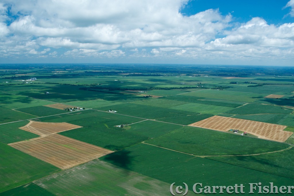
As I took off into the pleasant morning air, it was evident how nice the temperatures were and, like the prior morning I took off in, the air was very smooth. Cruising over the cornfields of Nebraska was quite enjoyable. It got even more enjoyable when I noticed my groundspeed: 92 knots. The airplane normally does about 70 knots with no wind, so this was translating into a 22kt tailwind, or 26 miles per hour. One knot is 1.15 miles per hour, a knot being the speed to represent a nautical mile. In other words, one knot of speed is one nautical mile per hour.
I enjoyed photographing quite a number of textured fields as I flew. It’s a project that I am working on, documenting farm fields from above. The textures are worthy of an art gallery, amazing features of art that appear dull on the ground. It gave me something to do absent epic and deadly terrain to fly into.
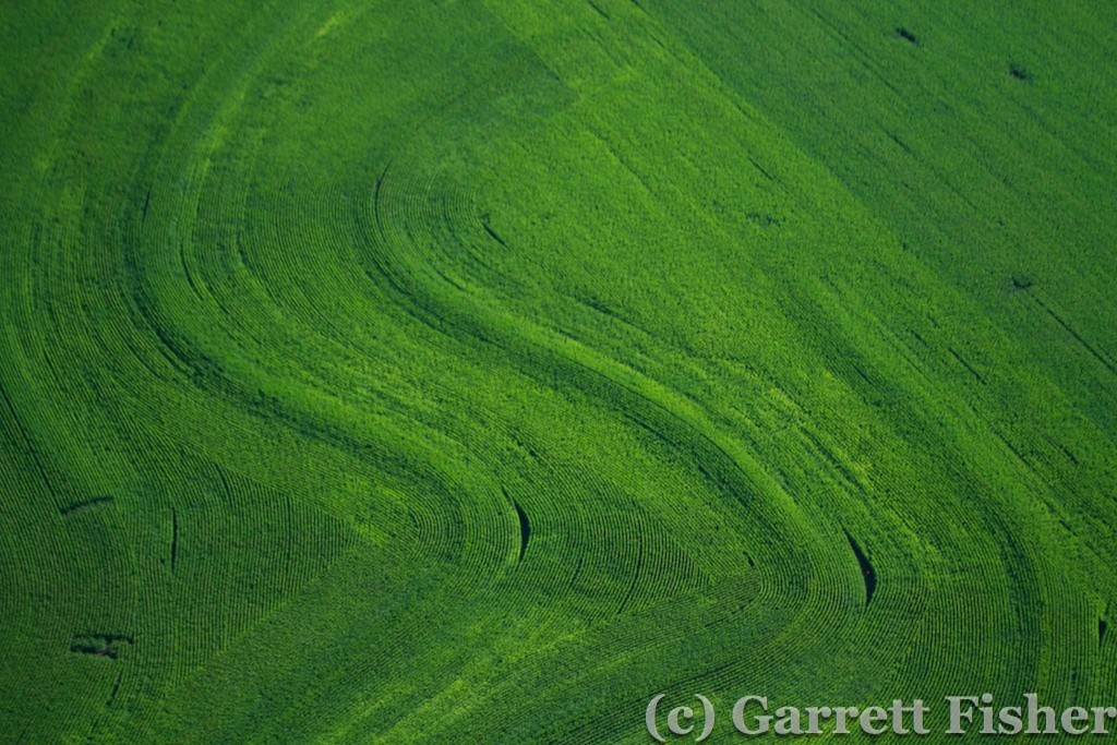
Textured Farm Field – Nebraska
About 2 hours into the flight, I came up to what looked like a sizable river. I assumed it was the Missouri, and my iPad confirmed it. As I approached, I looked at the state lines and realized that I was about to fly over a shred of Kansas! Gasping, I steered the airplane 30 degrees left, to avoid a one-mile incursion into the “reservoir of bad ideas” (ref. Paul Krugman, economist). I don’t like Kansas and, if I can spitefully avoid flying over it, all the better.
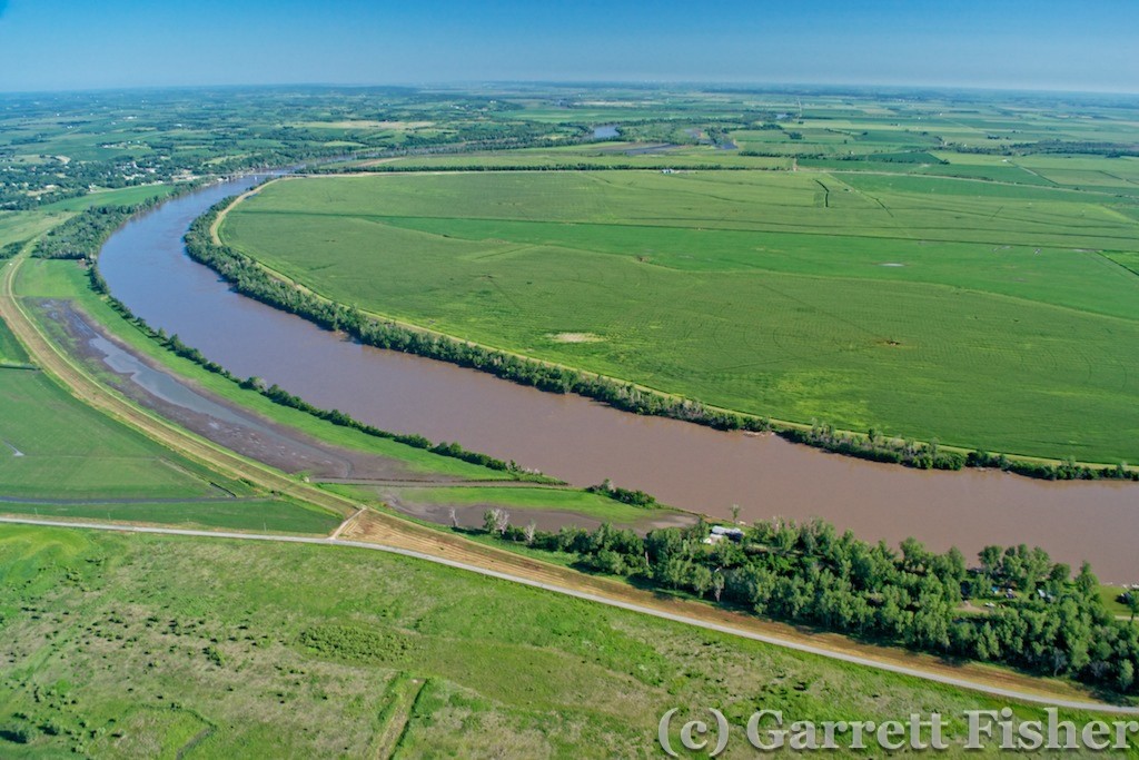
Missouri River – Just north of “Reservoir of Bad Ideas” (Kansas) – NE/MO Border

Farm Fields in Missouri River Floodplain
Passing north of St. Joseph, MO, I landed in Cameron, MO to refuel. Three hours of flying and I was making incredible time. I realized at that moment that maybe, if the tailwind continues, I’ll make it to NC. Or worse, I’ll make it an hour from home.
Pressing on, Missouri was quite green given recent rains, though it all looked the same. Two hours later, I passed north of St. Louis and crossed the Mississippi River into Illinois. The fields took on a more square structure here. Tailwinds continuing, I landed in Greenville, IL, thankfully on a grass strip that crosses the main runway. The grass strip was straight into the wind, which was blowing quite strong. With the headwind and resistance of grass turf, I was able to set the plane down and turn off in 500 feet, for a quick fuel stop.
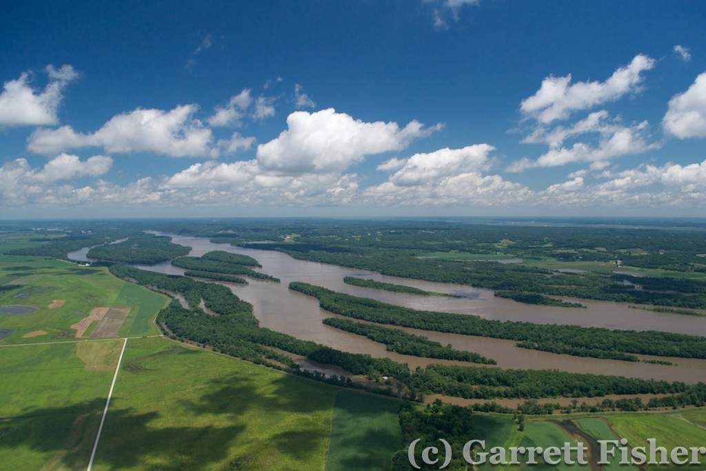
Mississippi River – IL to Right, MO to Left
A check of upper level winds showed that they wouldn’t hold and likely would shift at the KY line. If I could get to 9000 feet, I would be able to keep a tailwind. So I tried to out climb the clouds, and it wasn’t working. At 4000 feet, I was at the bases, and they looked anywhere from 2,000 to 10,000 feet tall, so while that would be pretty, it would not help me out any. The tailwinds, in contravention of the forecast, were less at altitude. I descended back down to my routine of 1,000 to 1,500 feet above the ground.
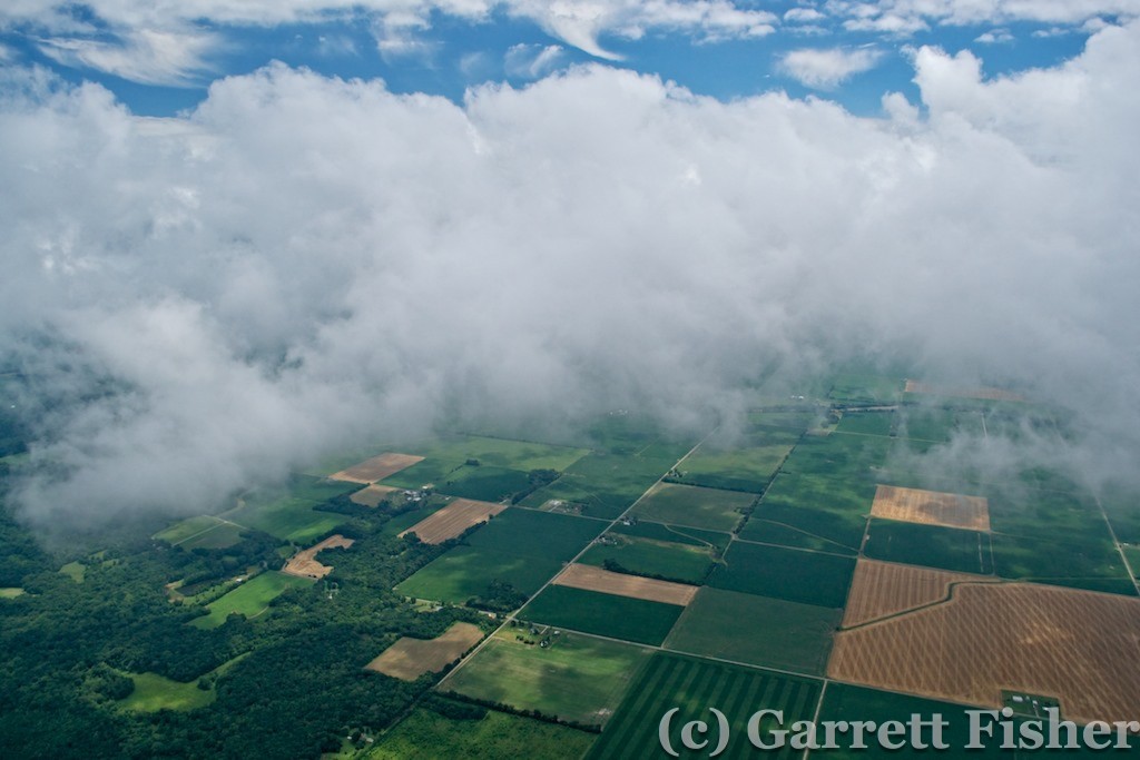
Above the Clouds Didn’t Work Like I Expected – Illinois
As I crossed the Wabash River, I noted a state line on the map. Indiana. I didn’t expect that. My line of flight took me into the state for 30 minutes, passing north of Evansville and then into Kentucky, crossing the Ohio River. My backup camera battery finally died north of Evansville, and that was the end of the photography. Fiddlesticks.

Wabash River – Dead Battery – No More Photos for you! IL to the left, IN to the right
I got to southeastern KY, having crossed much of the “unbridled spirit” state though feeling quite bridled in a small cockpit, and attempted to refuel at Russell County airport. Dodging a strong rain shower, and performing the most insane landing in my life, with brutal crosswinds, I pulled up to the fuel pump. Some guy on a lawn mower yells “No fuel!” and drives away. Milling around trying to find a live human that will have a conversation, they confirm that there is no fuel, will not be until tomorrow, and it was advised via NOTAM. I snarkily advised that my NOTAM listing does not have the fuel advisory. Oh well. My fuel was quite low as it was, and I was not thrilled with having to do another stupid landing with that wind.
Since the wind was howling, it was only 10 minutes to Wayne County airport in Monticello. I landed before the paved runway in the field to avoid the travails of pavement, crosswinds, and tail wheels mixing. They actually had fuel there, so I ran like a madman to fuel up and make haste. The kind Kentucky folks were having some form of Board meeting at the airport, looking at me like I was deranged and stupid.
A check of the radar revealed bleak prospects. Not one, but two lines of thunderstorms were between me and Charlotte, though I was 194nm from home. Not bad given that I have been able to get up to 235nm out of a tank with 45 minutes to spare. I would get home tonight if I could get through, which I honestly didn’t think was likely. I was counting on the one-hour lifecycle of a thunderstorm to mean that, by the time I got to them, the lines would reconfigure and provide me a window.
I passed over into some terrain in Tennessee, with rain showers and lightning to the left (northeast) and some towering cumulonimbus to the right (southeast). As I passed over some quite pretty terrain in a national forest, I thought first of my impotent cameras and second, I AM SICK AND TIRED OF EXPECTING TO DIE IF THE ENGINE QUITS. It was 100% trees, no cell coverage, no roads, nowhere to land. Fortunately, that gave way to civilization, cell coverage, and clearings.
As I got into the Tennessee Valley, the sky was dark and rain was ahead. There were wispy low clouds, typical in the south after a giant rainstorm. I was concerned that they would sock in under me, as I was flying above them. Further analysis showed that they were on the move, and I would be all right. The bigger concern was the rain ahead and what that meant. There was a hole in the rain shield, with legal visibilities and cloud clearances in it. Radar finally refreshed with some cell coverage and, as I assumed, the line was converting into stratoform rains. The atmosphere had spent its convective energy, something I was hoping for as the front was expected not to make it over the Appalachians.
The rain was moving at a fast clip. It took what seemed like 30 minutes to catch up to it. Meanwhile, I had concern the hole would close on me. I tracked nearest airports in all directions – through the hole, behind me, even in directions I didn’t plan on going. If the situation got dire, I would need an escape plan. Fortunately, I was finally able to catch up to the line roughly over I-81. It was moderate rain at best with 3-mile visibility. Morristown, TN was my backup plan as I plunged into the precipitation.
My secondary concern was the second line over the NC mountains. What would the line do? What would the clouds do? My gut was telling me it would be fine, however the rain was not abating on the other side of the line and there were a healthy amount of low clouds, low enough that I knew they would be down over the mountain ridges. As I got closer, the low clouds abated and the NC mountains came in clear view. The second line was converting to stratoform rain, also losing its convective energy and potential. Now it would only be a matter of sufficient visibility given rain, fog, clouds, and terrain. I added power to climb up to 4,000 feet to clear the first ridge. I expected the mountains to look far more ominous, being reminded of many airplane crashes and sad stories due to flying in weather exactly like what I was doing. Colorado had changed me. These were hills.
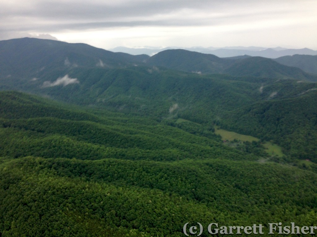
NC Hills – These can’t be considered mountains. Crummy iPhone shot.
Once I got to 4,000 feet, I could see over the ridge. The gap in the stronger cells materialized as the radar had shown, a window of opportunity north of Asheville and south of Mt. Mitchell, the highest peak east of the Rockies at 6,674’. At this point, I will be damned if I have no photos of it to speak of, so I deleted some old pictures off the iPhone and snapped a few pictures. Between a full iPhone, dead Canon lens, and dead Nikon camera battery, I was pretty much out of photo options.
As I got closer to Mars Hill, visibility lowered in moderate rain to 2 miles in two quadrants. As such, I flew more to the north to remain within 1,200’ of the ground, thus remaining in Class G airspace with less restrictive visibility requirements. Class E was lower to the ground near Asheville (meaning visibility needed to be higher), so I had to stay away from there, even though it looked quite IFR, anyway.
Mt. Mitchell was shrouded in clouds, as were the rest of the mountains down to 5,500 feet or so. I crossed the Blue Ridge Parkway in a very wooded, beautifully green section, with very pretty clouds moving around the peaks to my north. I could see the Piedmont – and I will make it home – despite some lingering rain showers here and there. I texted the wife and the owner of the hangar than I will be in around 8PM.
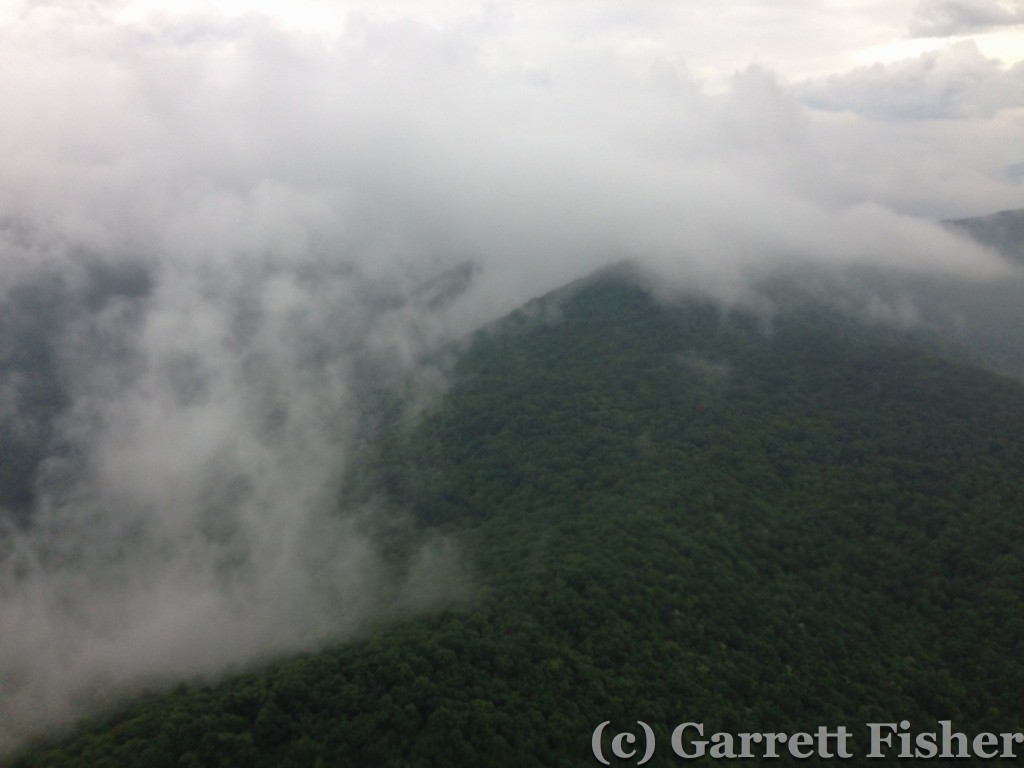
The tallest mountain east of the Rockies is hiding in there. Ho Hum. North of Asheville, NC. iPhone shot.
The remaining route took me on the south side of South Mountains State Park, the nearest mountains to Charlotte and the source of the cleanest water in the state. As I flew over this now innocuous terrain, I had the warmest, fuzziest feeling that I did it. I had just flown over 2,300 miles, 34 hours of flying time, and some absolutely stunning terrain and experiences. I had approached the adventure as a simple flight from CO to NC, with some added spice going to Yellowstone. That is a tendency of mine, to get very literal about things – “its just a flight, what’s the big deal?” If I can piece individual pieces of a large project together, each piece doable in isolation with relative ease, then I mathematically transfer the ease to the entire project, and categorically only feel the “normal” emotions afterward. For example, when completing the final photo of the 14ers project (you’ll see the book forthcoming), it hit me how risky the whole thing was. Each flight and each mountain wasn’t so bad. All 54? In the winter? What the hell was I thinking?
Even better was the fact that I crossed one half of North America, in one day, in a Piper Cub! 1071 miles! That is statistically extremely unlikely if someone wanted to repeat it. The 20kt tailwind was 40kt at times, never less than 15kt, all day. The gaps in the weather were timed perfectly and opened despite forecast intentions. The trip was the longest I have ever taken, over some of the most interesting terrain (most of it very problematic if the engine quit). I had camped beside the airplane for the first time, interacted with 5 lines of storms, 3 time zones, 11 states, 7 mountain ranges, 3 national parks, 14 airports, 35F to 100F temperatures, ground winds to 30mph, a 26 hour mechanical delay, and altitudes to 14,000 feet (without oxygen). All of it was done with no radio, no lights, no transponder, a compass, iPhone, iPad, and a map. And it was AWESOME.
The best part? Within days of landing, our plans started to firm up that the plane will be heading very, very far west in the near future. It looks like my ass will take the shape of that airplane seat, after all. Stay tuned.

