
There is something to be said about bad weather, and all the more so, flying in it. Conceptually, a person, place, or thing is only as strong as it can withstand the storms presented to it. Aerial photography, although an adventure sport, has a tendency toward good weather: clear skies, low wind, no clouds, and the like, all in the name of a better photograph. After countless flights on the coast, it occurred to me that a flight on a miserable day might yield something that a pleasant day would not.
A visitor was in town, so we went to the North Carolina Aquarium in Manteo, which happens to be right next to the airport, a 90-minute drive from the house. Suffice it to say, I don’t just drive down to the airport for fun, it is done with careful planning. Today, the weather was pretty much garbage: 20mph to 30mph south wind, extremely humid, overcast, and on/off fog. This was the perfect opportunity to test my foul weather theory.
Tactically speaking, it was a nightmare. Legally, it was permissible. Skies were overcast, and high enough to takeoff. Visibility was technically 8 miles, though there was ground fog hanging over Croatan Sound, from zero to 50 feet, stationary. There was ground fog on Bodie Island as we drove, so a sandwich was formed, with a clear spot in between. Researching the weather, the entire eastern seaboard was IFR conditions (instrument only, instruments of which I do not have), except for sections of the Outer Banks. My plan was to takeoff, and see what I found. If it was sour, land. If it was doable, explore. I didn’t think I’d cross the sound to the beach and, if I did and Dare County Airport socked in, First Flight Airport was my backup.
Taking off, there were a few wispy puffs at 350’, low density, and they blew through. Fog over the sound was stationary, and the coast was visible, with some fog blowing in off the ocean. My visitor and I crossed the sound, at a 45-degree angle, due to the howling south wind. Arriving at the coast, there was advection fog ebbing and flowing. Flying over the waters of the Atlantic, I descended to the top of the fog: 200’ above the water. This is legal due to distance from people, vehicles, and buildings. Bodie Island Lighthouse was regaled in splendor, now my second OBX lighthouse captured from the airplane in fog. The first (see Dec 23rd blog post) was Cape Lookout Lighthouse, and half of the top was in fog. Now I have one sticking out of the fog in the opposite direction.
The flight went off without a hitch. Landing was a breeze, as there are perpendicular runways at KMQI, and one was into the wind. All in all, a very pleasant flight, and a photogenic way to portray the variety of weather at the coast. In retrospect, the water temperatures of the sound were actually negating the inversion fog that was covering half of the state, though the cold waters were creating advection fog very close to the water itself, quite a fascinating duality.
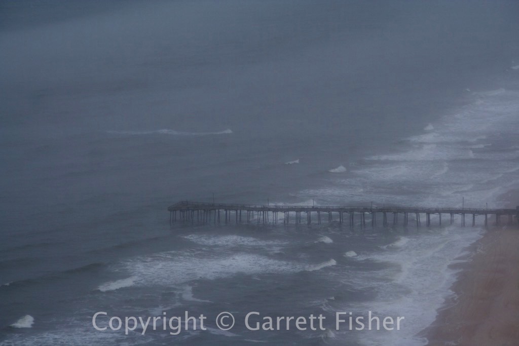
Nags Head Pier in Fog
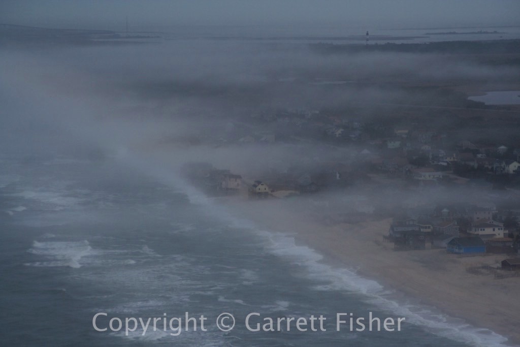
Smashed Houses in Fog – Nags Head, NC
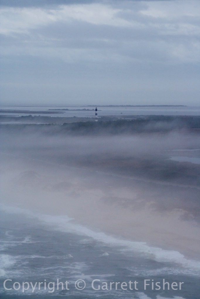
Atlantic Ocean, Bodie Island Lighthouse
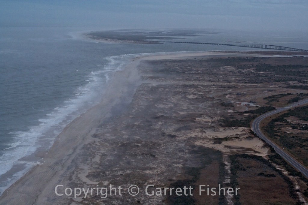
Oregon Inlet with Advection Fog
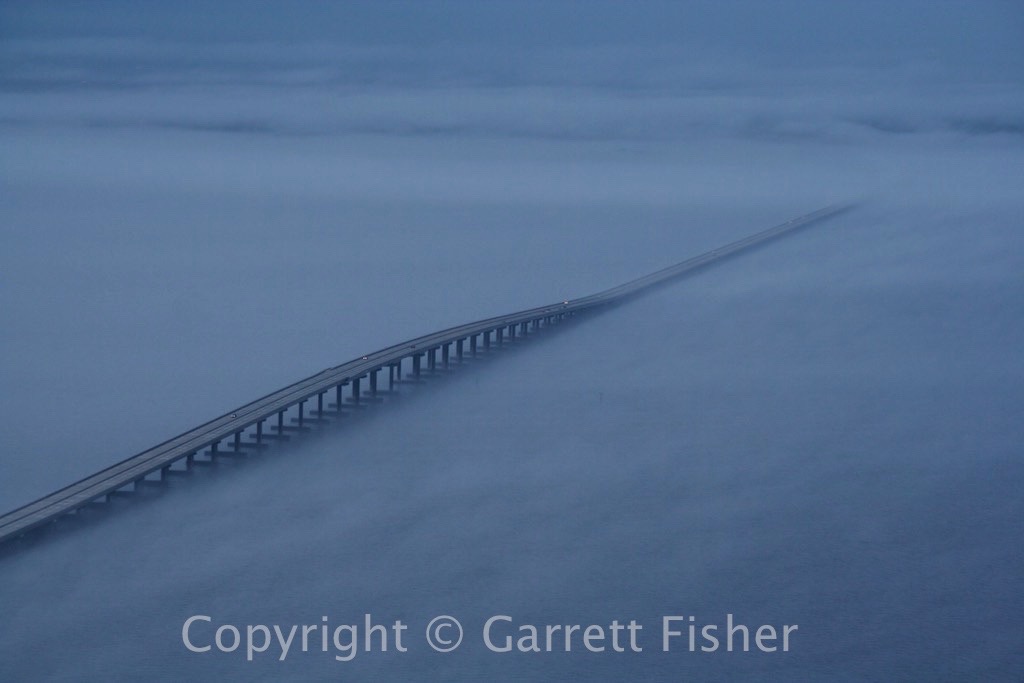
US 64 Bridge over Croatan Sound